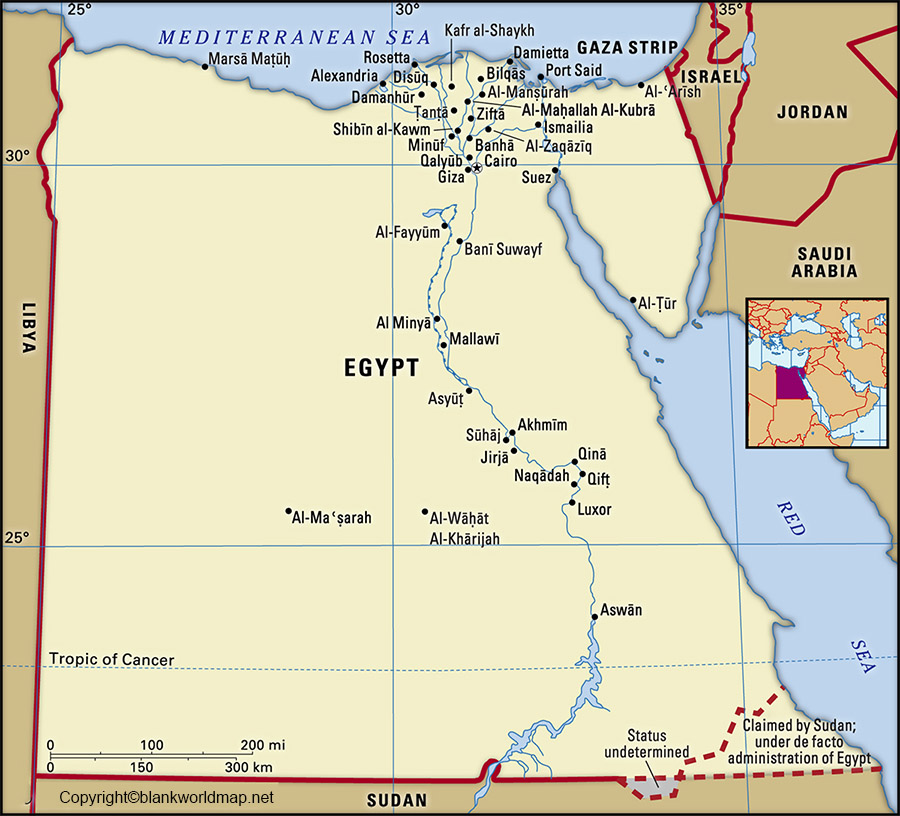
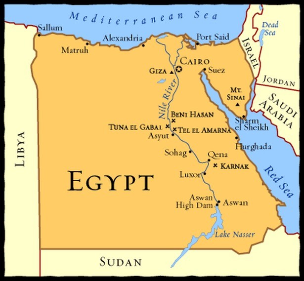
Egypt is located in Africa and connects Northeastern Africa to the Middle East. Although some people mistakenly think of Egypt as just a Middle Eastern country, it is firmly part of the African continent. This location makes Egypt unique, as it serves as a bridge between Africa and the Middle East. In the western side of the country, Egypt borders Libya, whereas in the Southern border, it links with Sudan. Two seas surround Egypt: the Mediterranean in the North and the Red Sea to the East.
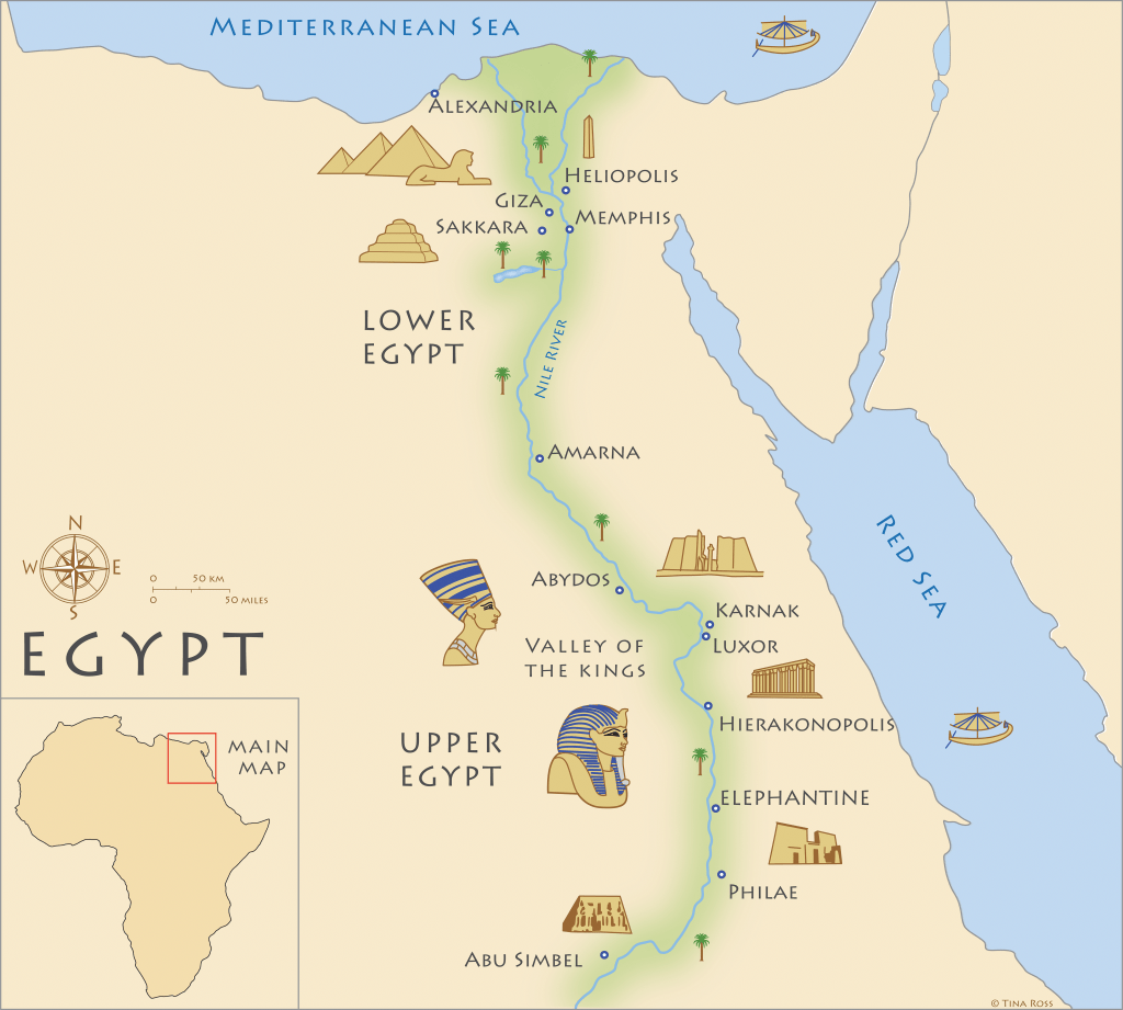
The capital city, Cairo, hosts the triangular Nile River Delta. The country has a blend of mountains, deserts, valleys, and coral reefs. The map for Egypt today is different from Ancient Egypt. In ancient times, Egypt was divided into two regions called Upper Egypt and Lower Egypt. Although the terms ‘Upper’ and ‘Lower’ may seem confusing, they refer to the elevation and direction of the Nile River, not north and south on a map. Upper Egypt is actually in the south, from Aswan to the area south of Cairo, because it is upriver and at a higher elevation. Lower Egypt is in the north, made up primarily of the Nile Delta region, where the river flows into the Mediterranean Sea. This area is called ‘Lower’ because it is downriver and at a lower elevation. In summary, Upper Egypt lies in the southern part along the Nile’s higher terrain, while Lower Egypt is in the north with wide valleys and fertile lands near the sea. The deserts can be found east and west of both Northern and Southern Egypt. The regions were connected by King Narmer (or Menes) around 3100 BC, forming Egypt.
Slideshow

Leave a comment