The Arabic term for national unity is referred to as ‘Wihda Wataniya,’ and this is deeply embedded within the Sudanese culture, where several key values arise: solidarity, respect, and tolerance between the people of Sudan. This idea is often seen in how communities come together to celebrate national holidays, such as Independence Day, where people from different backgrounds participate in festivities that emphasize their common identity. The Sudanese are identified by their tribes rather than their nation. There are more than fifty tribes. Jamala and Nubians in the North. Beja in the Red Sea Hills. In the south, there are Nilotic groups, which include Azande, Dinka, Nuer, and Shilluk. In Sudanese politics, Wihda Wataniya is expressed through efforts to form inclusive governments that represent various regions and ethnic groups. For example, local conflicts are sometimes resolved by large gatherings called “joud” or reconciliation councils, where elders from different tribes mediate and encourage peaceful solutions to disputes, demonstrating respect and unity in practice.
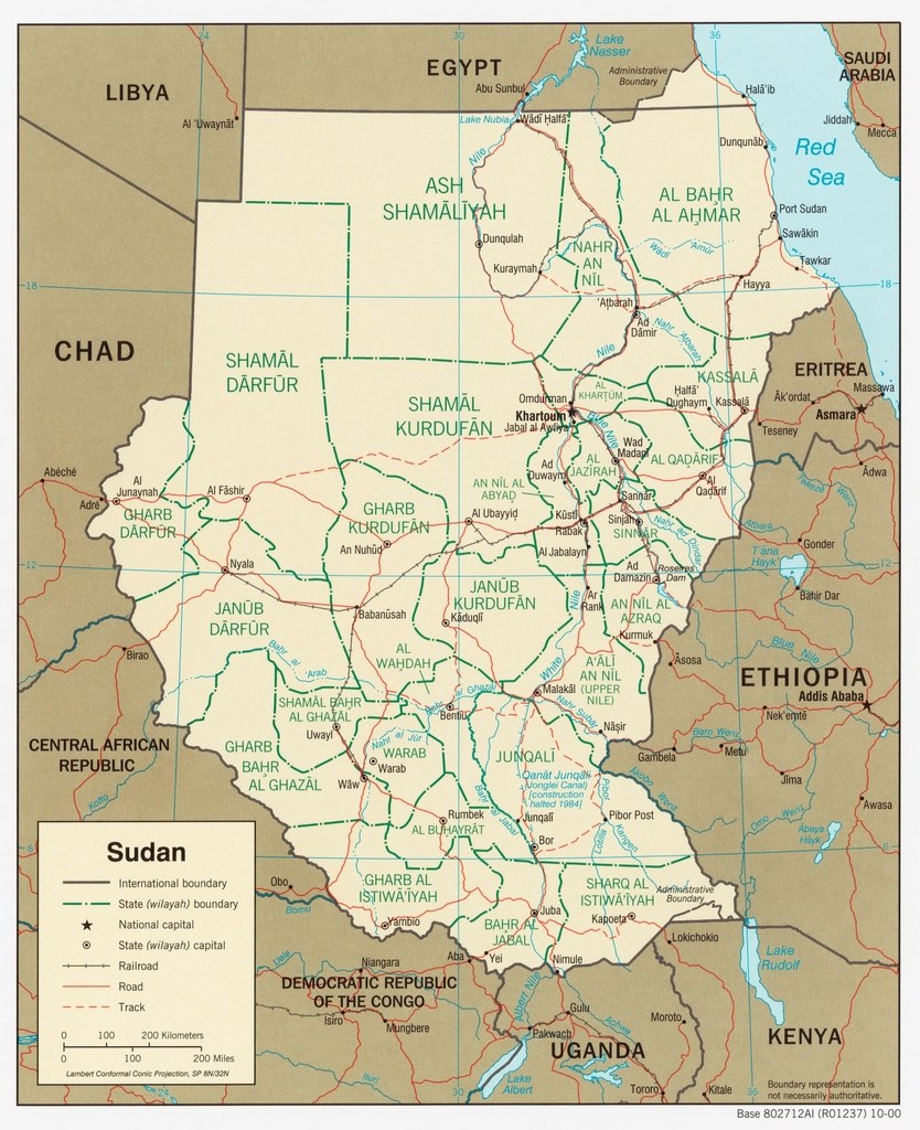
Sudan is the ninth-largest country in the world, covering about one million square miles. It is located in North-Eastern Africa, sharing borders with Egypt to the north, the Red Sea to the east, Eritrea and Ethiopia to the southeast, South Sudan to the south, the Central African Republic to the southwest, Chad to the west, and Libya to the northwest. The capital, Khartoum, is home to much of the population. 35.42% of the population is urban (18,873,944 people in 2026), while the remainder is rural, particularly in the central region, where plains support agriculture thanks to abundant rainfall, unlike the north, which receives minimal rainfall. Over recent decades, Sudan has experienced a steady increase in urbanization, with more people moving to cities such as Khartoum in search of employment, education, and better access to services. This trend is driven by factors such as rural-to-urban migration, population growth, and the development of urban infrastructure.
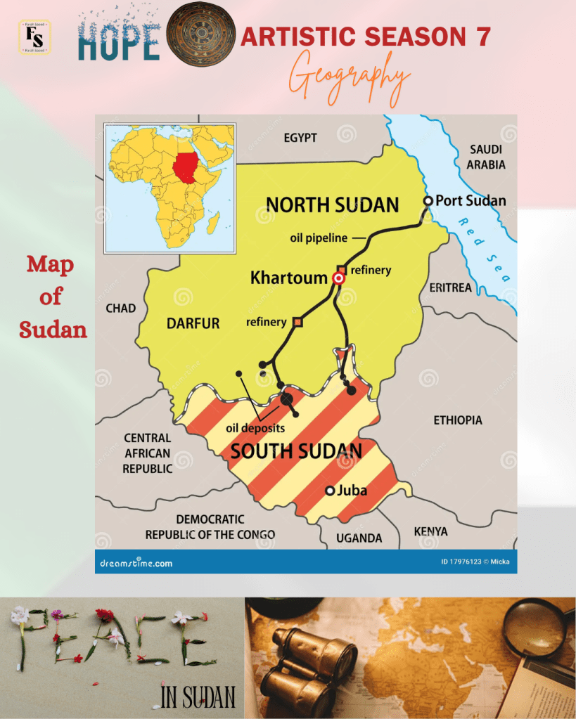
South Sudan sought independence from Sudan on 9th July 2011 after many years of civil war. It borders Sudan to the north, Ethiopia to the east, Kenya to the southeast, Uganda to the south, Democratic Republic of the Congo to the southwest, and the Central African Republic to the west. The capital city is Juba, and the country features diverse landscapes, including vast plains, savannahs, and forested mountains.
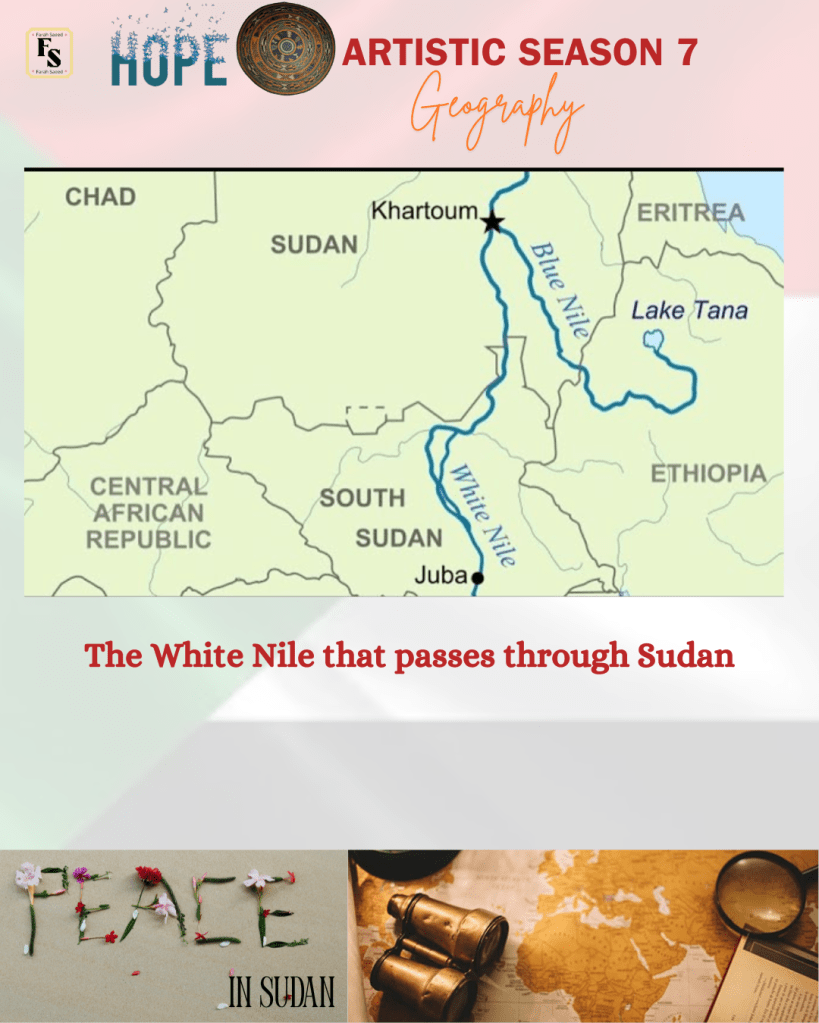
The River Nile passes through the Republic of Sudan and South Sudan. The White Nile drains into the manmade lake called Lake Nubia in the north. Khartoum boasts beautiful, tree-lined streets and gardens. There is a range of wildlife from crocodiles and hippos in the rivers to elephants, mainly in the south. The plains have a range of carnivores like lions and leopards, and poisonous reptiles. There are several tropical bird species.
Slideshow
References
Countries and their cultures (2026) Sudan Available at: https://www.everyculture.com/Sa-Th/Sudan.html (Accessed: 26th April 2026)
Legal Clarity Team (2026) When Was South Sudan Founded? History and Independence. Available at: https://legalclarity.org/when-was-south-sudan-founded-as-a-sovereign-state/ (Accessed: 26th April 2026)
World Atlas (2026) Religious Beliefs In Sudan. Available at: https://www.worldatlas.com/articles/religious-beliefs-in-sudan.html (Accessed: 26th April 2026)
Worldometer (2026) Sudan Population Available at: https://www.worldometers.info/world-population/sudan-population/ (Accessed: 26th April 2026)

Leave a comment