
Besides the monuments and temples found in the cities, there are various archaeological sites in Egypt on islands and oases that reflect major historical periods from the prehistoric, Pharaonic, Ptolemaic, Persian, Coptic, Ottoman, and later eras. These sites enable archaeologists and Egyptologists to explore and understand how Egypt has evolved through its civilizations. This article will argue that the islands and oases of Egypt are not only geographically distinct but have also played unique roles as centers of religious, cultural, economic, and strategic significance. By examining notable examples, the text aims to demonstrate how these locations contributed to shaping Egypt’s history and facilitated connections between diverse peoples and cultures. It is important to distinguish the differences between islands and oases.
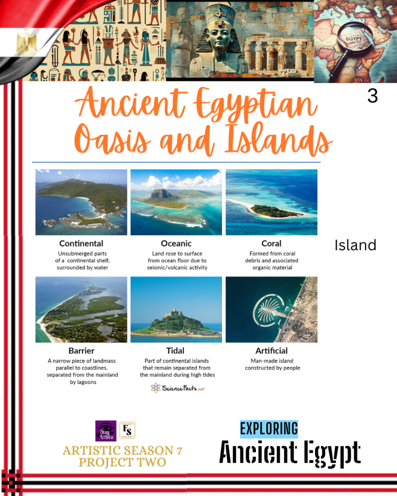
An island is a piece of subcontinental land that is surrounded by water. It arises from complex interactions and forces of nature. Some arise as a result of the action of the ocean, rocks, and accumulation of sand, silt, and gravel that are sensitive to the coastal weather. Others form as a result of the growth of tiny organisms called coral polyps that secrete calcium carbonate, which forms limestone reefs in shallow tropical waters. Some of the islands in Egypt, for instance, Elephantine and Nelson, do not hold characteristics of an island. They are considered large ancient Egyptian archaeological sites. On the other hand, Zabargad Island, otherwise known as St. John’s Island, is a geological formation that is uplifted as part of the hot upper mantle and is not classified as a volcanic island.
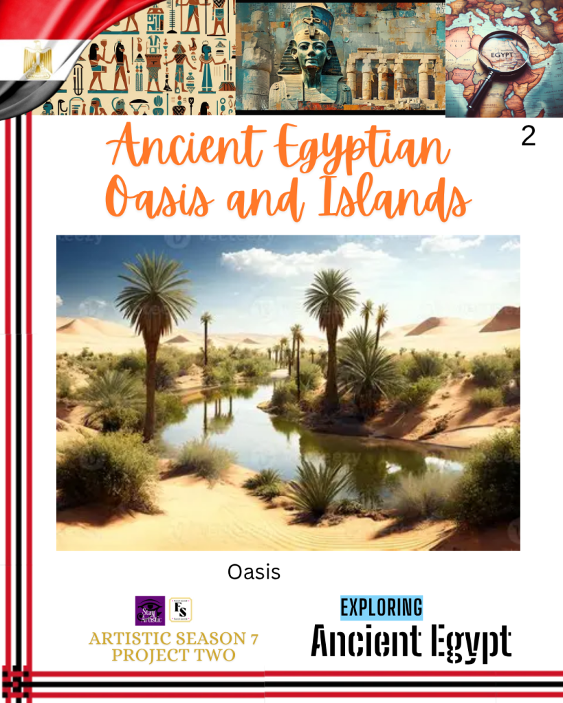
An oasis is a fertile or green area in a desert that consists of plants and flora and has water and wells that nourish the area. The largest oasis found in Egypt is Kharga Oasis in the centre of the Western Desert. Over the millennia, it was a significant place for religion, trade, and habitation. The aim of this article is to provide an insight into the historical nature of some of Egypt’s islands and oases that hold importance as cultic centers and sites of history, diplomacy, military garrisons, and strategic points for trade in the south.
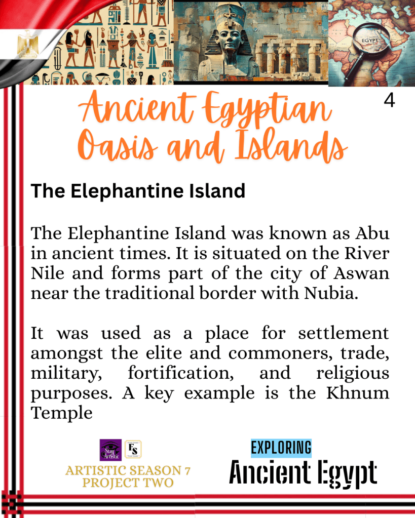
The Elephantine Island
The Elephantine Island was known as Abu in ancient times. It is situated on the River Nile and forms part of the city of Aswan near the traditional border with Nubia. It is the capital city of the Upper Egyptian Nome. A Nome is the Greek word for “province” or administrative region”. Elephantine Island was a border post between Egypt and Nubia. The Elephantine Island is near the First Cataract at the Southern border of Upper Egypt. A cataract is naturally formed and consists of large rapids of water over rocks or waterfalls along the Nile River. From the North to the South, it is 1200 metres (3900 feet), and it is 400 metres wide (1300 feet). On an aerial view, it is shaped as an elephant (head and trunk). The rocks around the banks may also resemble the shape of the large mammal.
There are archaeological remains of temples dating from the Prehistorical period (before circa 2686 BCE, estimated to be 31000-2686 BCE), Old Kingdom (circa 2686-2181 BCE), First Intermediate Period (circa 2191-2055 BCE), and Middle Kingdom (circa 2040-1650 BCE) between Upper Egypt and Nubia. This estimated a clear progression of building levels from different eras.
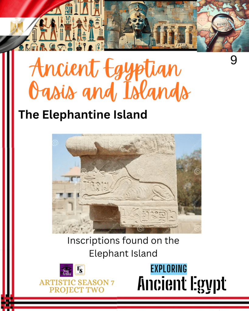
It was constantly used as a pivotal source of settlement and residence for the commoners and the elite, a trade route, an administrative and military centre, a fortification, and a buffer zone during moments of instability. There were also inscriptions documenting expeditions for exotic goods such as incense, granite, ivory, and gold arriving from Nubia. However, after the Third Intermediate and Late Periods (circa 1077-332 BCE), it was central solely for religious and military purposes.
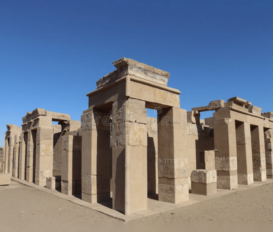
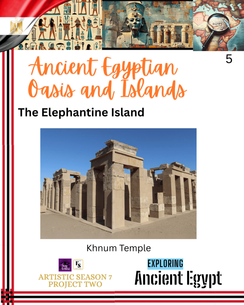
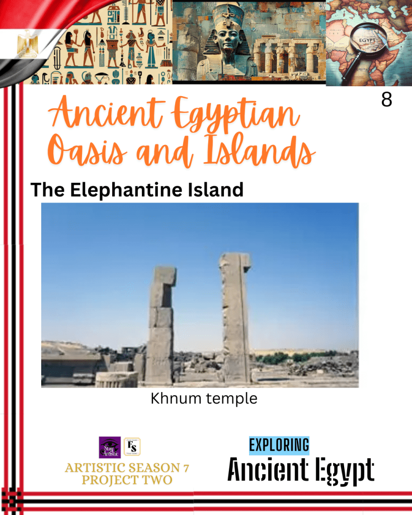
Khnum Temple
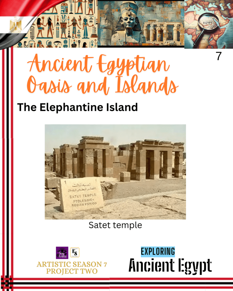
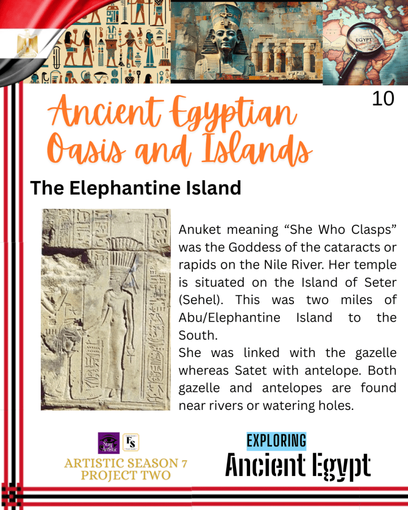
The ram-headed god of the cataracts, Khnum, whose temple is amongst the archaeological remains at the Elephantine island, indicated he was worshipped for protecting the Nile waters. He was also believed to create human beings from clay using a potter’s wheel. Khnum was part of the Elephantine Triad alongside Satet, his consort, and together they had a daughter by the name of Anuket, who also had protective functions. Satet was the goddess of the flood, whereas Anuket is the goddess of the cataracts or rapids on the Nile. Both were also goddesses of fertility and inundation. There was an annual inundation of the Nile, whose floodwaters overflowed into the fields along the banks. On the other hand, other sources indicate they may be sister goddesses or two aspects of the same goddess. They were later said to be paralleled with Osiris, Isis, and Nephthys, as Isis and Nephthys were sister Goddesses.
In the Old Kingdom era, the temple of Khnum received royal patronage, and during the Middle Kingdom, it was rebuilt and later evolved, then expanded during the Ptolemaic and Roman eras for worshippers. This emphasises his spiritual importance for the region at the time, symbolic of fertility, survival, creation and waters to maintain the Nile’s seasonal rise; otherwise, agriculture would fail. Near the temple of Khnum, there is a Nilometer that was used to measure the height of the Nile during the annual flood.
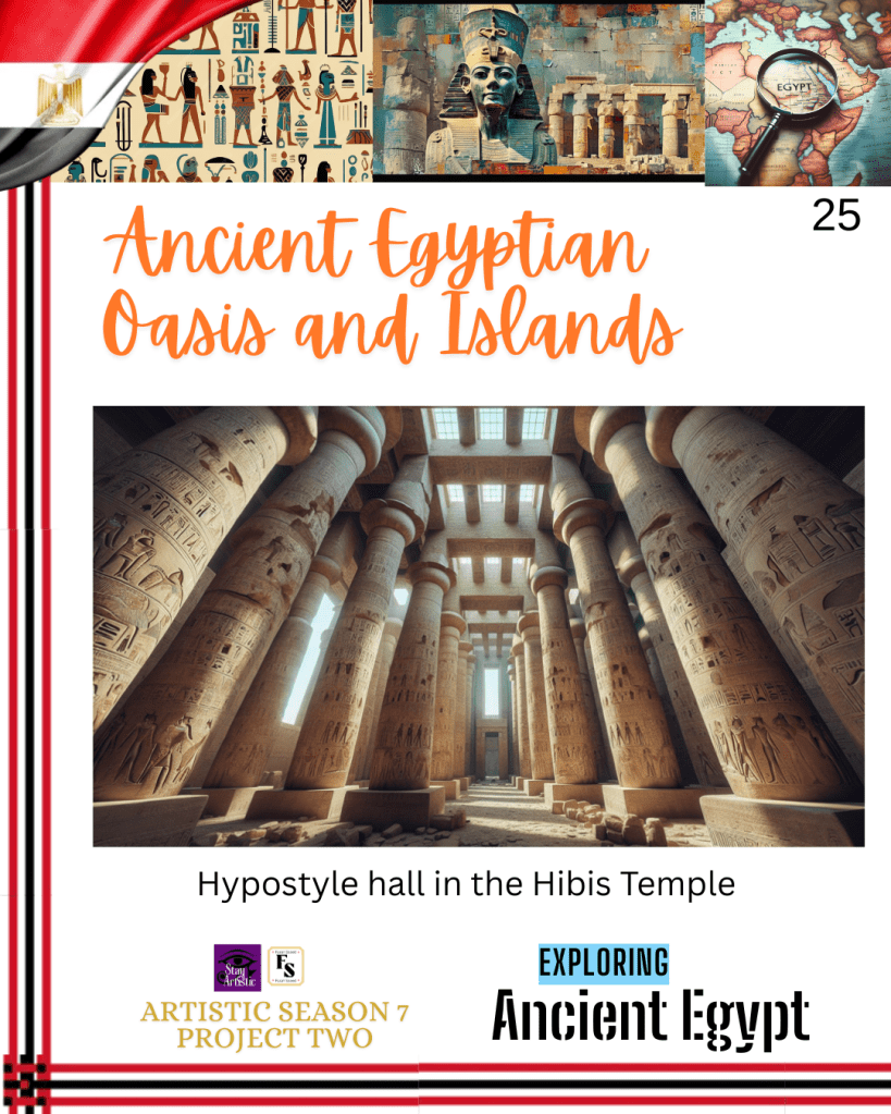
Archaeologists like C.von Pilgrim, who directed a mission to investigate the area and found that the temple consisted of pylons, courts lined with thick sandstone columns with palm and lotus capitals that correspond to the lush vegetation of the Nile. These were referred to as a hypostyle hall. Other compartments included a forecourt and a hypothetical festival hall of the Pharaoh Amenhotep II. A pylon is a granite gateway to an ancient Egyptian temple and is formed by two truncated pyramid-shaped towers. There are also surviving reliefs and inscriptions from the times of the Ptolemaic and Roman periods as a means of protection. This indicates the level of artistry, craftsmanship, and the effort made in order to bring order and governance over the Nile. The most sacred space was the sanctuary where ritual objects, preparation of offerings, and purification rites were performed.
Over time, there was a decline due to changes in the economy, environment, and the rise of social unrest, which led to its abandonment as a major urban center.
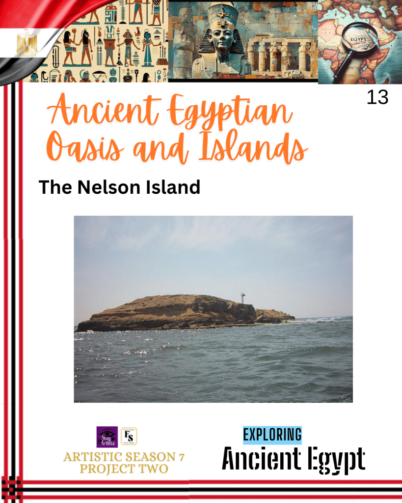
Nelson Island
The Nelson Islands were situated in the Mediterranean Sea in Aboukir Bay. This is 18 kilometers from the centre of Alexandria. The name Nelson was renamed by British Navy soldiers who occupied Abukir Islands and was a sensitive target after the Battle of the Nile during the British-French wars in 1798, after their admiral, Horatio Nelson.
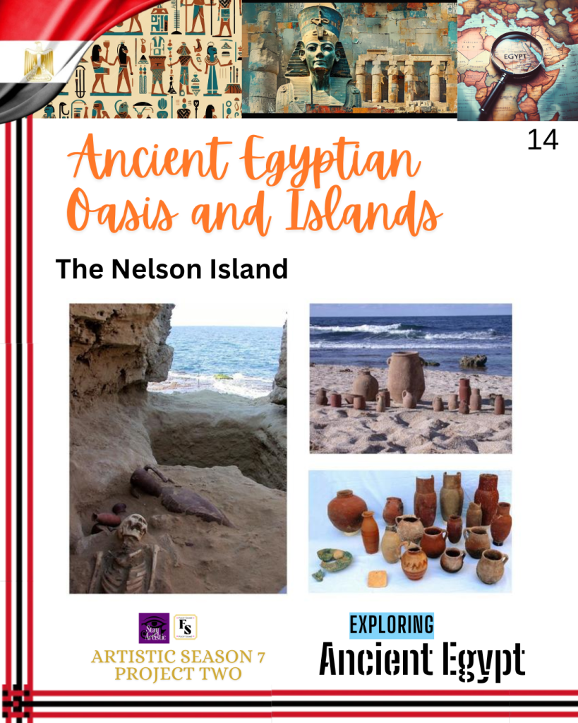
The archaeological study of Nelson Island was initially started by Paolo Gallo from the University of Turin in 1998. They discovered remnants of a Greek settlement from the Early Hellenistic Period (325-275 BC) over the Egyptian necropolis (6th to 4th century BC) by the last Pharaohs during the last dynasty.
Greek colonists settled in Alexandria at the beginning of the Ptolemaic period under King Ptolemy I. The remains on Nelson Island include monuments and huge stone walls, which are 5 meters thick, constructed to protect the eastern side of the settlement. On the western side, archaeologists have found a Doric monument, where the columns measure between 7 and 8 meters in height. Water for the settlement was supplied by a public cistern that measured 26 metres in length and 13 metres in height. It was connected to basins with a total capacity of 1000 cubic meters to collect rainwater. Further studies are required to fully understand the large, decorated houses and their multiple compartments, which contrast with the archaeological findings in Alexandria itself, where no complete houses have been discovered.
It was short-lived for unknown reasons, and it was abundant only during the first quarter of the 3rd century BCE, when archaeologists found everything left behind and undisturbed. Possible reasons were a geological revolution that transformed it. In the 5th century CE, it became a stone quarry where workers formed a poor settlement and abandoned it towards the end of the 7th century.
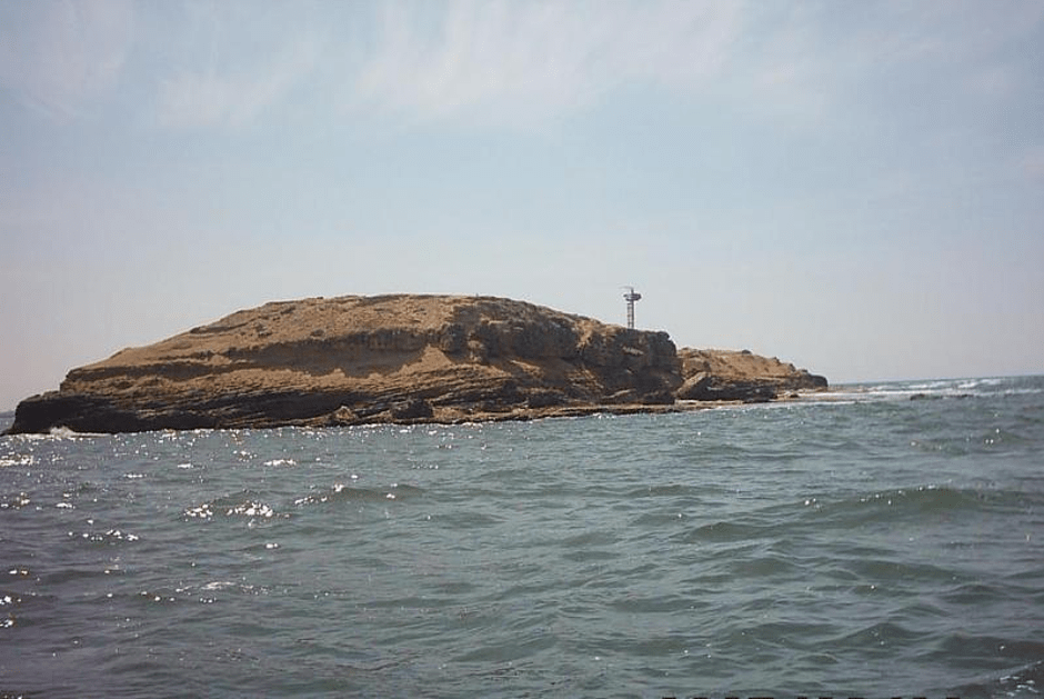
Zabargad Island
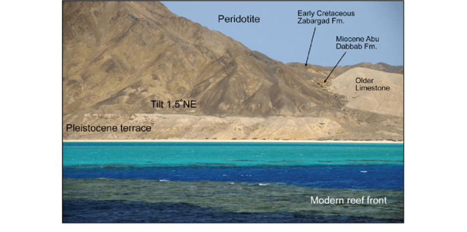
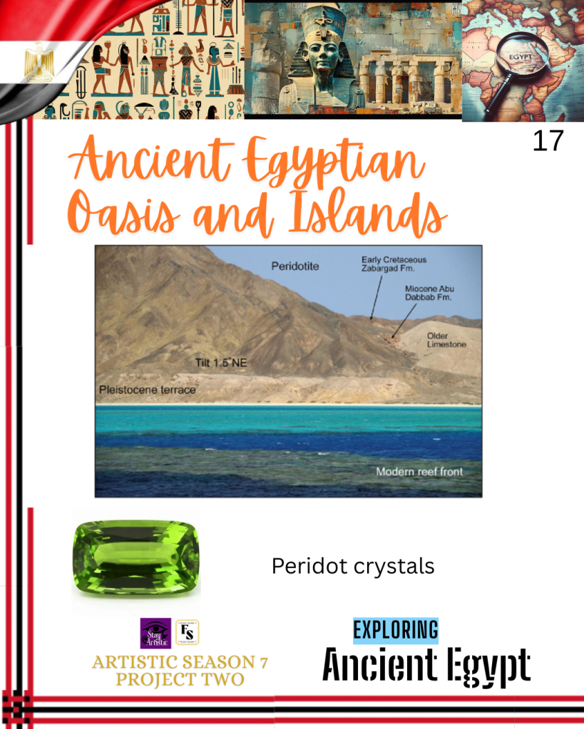
The geological island, otherwise known as St. John’s Islands, is in the Red Sea. It is situated on top of the African and Arabian tectonic plates. The Red Sea Rift is a mid-ocean ridge that crosses between them, and it intersects with the East African rift valley.
Zabargad island is around 50 kilometres off the Southern Egypt in the Red Sea in an area called Foul Bay. It is 4.5 square kilometres in size. The highest ground is called Peridot Hill (235 m above sea level) and smaller hills (135 m above sea level). It is currently conserved and is part of the Elba National Park, but has been closed to the public because of damage to the breeding birds and corals. Amongst the birds is the sooty falcon (Falco concolor) in 1994. The corals mainly consist of octopus, cuttlefish, crocodile fish, eels, and rays. Other parts of the fauna contain reptiles and invertebrates adapted to the arid environment and harsh freshwater resources, shrubs, and grasses. This presents the significance of Zabargad Island to study nature: land and sea, and perform recreational activities.
Moreover, the island has stones and mining sites that trace back to the Ancient Egyptians over 3500 years ago. The mines were also used during the Hellenistic, medieval Arab, and European periods. It was originally thought that the Ancient Greeks called it Topazios, meaning topaz gemstones. However, it was later identified as peridotite. A rock found deep within the Earth’s mantle is evidence of Earth’s magmatic processes in the Earth’s mantle. Peridotite is a coarse-grained igneous rock that has high levels of olivine and pyroxene. A vibrant green gemstone known as peridot was extracted from peridotite rock with an olivine gem colour. The peridot crystals are formed at high pressures and brought to the surface through volcanic activity or tectonic uplift. Erosion and weathering led to further deposits of loose peridot crystals.
There are other types of volcanic rocks such as basalts and andesites. Younger volcanic rocks than peridotite that present later stages of geological evolution. Dr. Gubelin is a gemologist and honorary professor at the University of Stellenbosch, Switzerland, who visited the island in 1980 with his companion. He discovered that peridot crystals ranged from pale yellowish green to deep olive green. They had a pseudohexagonal shape that was between 5 and 15 mm in size along an axis. Some found sizes up to 10cm long, but between 2 and 4 cm were commonly found.
The peridot crystals were used in jewelry for Kings over ancient times. Other archaeologists indicated it had metaphysical properties that helped with healing, protection, and prosperity. It continues to be a source of wonder and inspiration for generations to come due to its vast geological composition, ecological parameters, and cultural heritage.
Kharja Oasis
The Kharja Oasis is the largest oasis of Egypt and is 200 km west of the Nile Valley. Alongside the Dakhla Oasis, it is known in ancient Egyptian hieroglyphs as wḥ3.t rsy.t, the ‘southern oasis ’, and holds archaeological remains from various eras indicating its purpose on a trans-national scale. The native Egyptologist A. Fakhry conducted a geological survey that allowed us to understand its significance in the Western Desert of Egypt. On its floor, there are mudlions called yardangs that serve as remains of the ancient lake and the geological past of the now-desert.
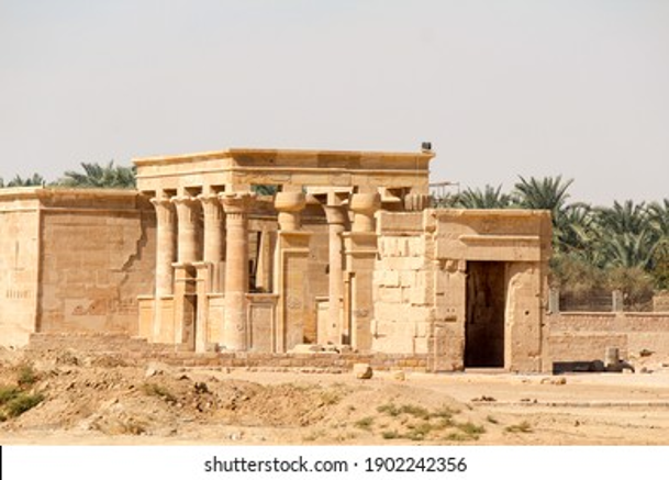
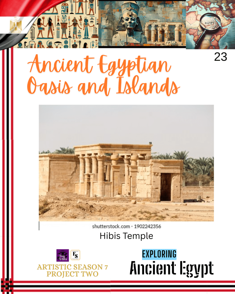
The temple of Amun at Hibis is amongst the primary settlements in the North of the modern town of Kharga. Hibis means “town of the plow”. Construction is dedicated to Darius I, who appears on its walls. Others argue it was during Psamtic II (595-589 BCE) because his name appears on the forecourt. It is likely Darius used Psamtik’s Horus name.
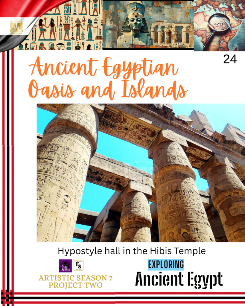
It consists of a forecourt, hypostyle hall, sanctuary, smaller rooms, and chapels. There is a larger hypostyle hall and portico at the entrance of the temple on the eastern side, where there is an enclosure wall and pylons. There are decorations on its interior and exterior walls where reliefs are dedicated to the goddesses: Amun, Mut, Khonsu, Osiris, and Horus. More goddesses are found on the main sanctuary estimated 7000 different gods. This was a cult topographical that served deities across Egypt and was a feature from the Ptolemaic and Roman periods.
Other areas that present the Pharaonic period were the Qasr Al-Ghweita that traces back to the New Kingdom.
Moreover, the Hibis temple and Kharja Oasis were of interest to Persian rulers. There are subterranean aqueducts called qanats or manawir in the south of the oasis: ʿAyn Manāwir, Dush, Dikura, ʿAyn Ziāda, and ʿAyn Boreq, similar to those in Iran. They vary in length. For instance, Ayn Manāwir, ranging in length from about 200 to 350 m, has a mudbrick temple, flanked by two clusters of houses. This illustrates the cross-cultural milieu of knowledge. The munawir was invented by the Persians in the 8th century BC and exported to the Kharja Oasis two centuries later during their rule of Egypt. The Romans adopted the same principle a thousand years later, but were longer in size (ten times more) and cultivated areas in a systematic way.
Overall, Egypt’s islands and oases played diverse roles across historical periods. Elephantine, Nelson, and Zabargad Islands each have unique archaeological and geological significance. Kharga Oasis was a major religious, trade, and cultural center with cross-cultural influences.
References
Antiquites Museum (2026) Nelson Island. Available at: https://antiquities.bibalex.org/Collection/Index.aspx?collection=743&lang=en (Accessed: 4th July 2026)
Biology Insights (2026) How Are Islands Formed? From Volcanoes to Coral Reefs. Available at: https://biologyinsights.com/how-are-islands-formed-from-volcanoes-to-coral-reefs/ (Accessed: 4th July 2026)
Bosworth, W., Taviani, M. and Rasul, N.M.A. (2018). Neotectonics of the Red Sea, Gulf of Suez and Gulf of Aqaba. Geological Setting, Palaeoenvironment and Archaeology of the Red Sea, pp.11–35. doi:https://doi.org/10.1007/978-3-319-99408-6_2.
Colburn, H. (2017) Kharga Oasis. Available at: https://www.iranicaonline.org/articles/kharga-oasis/ (Accessed: 4th July 2026)
Egypt Top Tours (2026) Temple of Khnum: The Sacred Sanctuary of the Nile’s Creator God. Available at: https://www.egypttoptours.com/Egypt/egypt-travel-information/aswan-attractions/temple-of-khnum (Accessed: 4th July 2026)
Everything Explained Today (2026) Zabargad Island Explained. Available at: https://everything.explained.today/Zabargad_Island/ (Accessed: 4th July 2026)
Flyriver (2026) Zabargad Island: A Geological and Historical Gem. Available at: https://www.flyriver.com/g/zabargad-island?auth=1783135132360 (Accessed: 4th July 2026)
Gubelin, E. (1981) Zabargad: The Ancient Peridot Island in the red sea. Available at: https://www.gia.edu/dam/jcr:92ada31c-4954-424f-b1ca-79af1022bb2f/Spring-1981-Gems-Gemology-Zabargad-Peridot-Island-Red-Sea.pdf (Accessed: 4th July 2026)
Hale, T. (2024) Zabargad Island: A Land Made Of Green Gemstones In The Red Sea. Available at: https://www.iflscience.com/zabargad-island-a-land-made-of-green-gemstones-in-the-red-sea-73925 (Accessed: 4th July 2026)
History Egypt (n.d.) Elephantine. Available at: https://historyegypt.org/settlements/elephantine (Accessed: 4th July 2026)
Soul of Egypt Travel (2025) Elephantine Island: The Ancient Gateway to Egypt’s Southern Border. Available at: https://soulofegypttravel.com/elephantine-island/ (Accessed: 4th July 2026)
The Editors of the Madain Project (2026) Elephantine. Available at: https://madainproject.com/elephantine#first-intermediate-period-and-middle-kingdom (Accessed: 4th July 2026)
The Shelby White and Leon Levy Program for Archaeological Publications (2016) The Excavations at Nelson Island, Egypt. Archaeological Rescue Excavations of the University of Torino (Italy) 1997-2016 Available at: https://whitelevy.fas.harvard.edu/excavations-nelson-island-egypt (Accessed: 4th July 2026)
Took, T. (2013) Anuket. Available at: https://www.thaliatook.com/OGOD/anuket.php (Accessed: 4th July 2026)
UNESCO World Heritage Centre (2026) Kharga Oasis and the Small Southern Oases. Available at: https://whc.unesco.org/en/tentativelists/6067/ (Accessed: 4th July 2026)

Leave a comment