Sudan contains islands and oases that preserve archaeological remains ranging from fossilized trees of the Paleolithic and Neolithic periods to the Egyptian fortified city of the New Kingdom (1539–1077 BCE) and the Ottoman fortress of the medieval era in the 14th century. Key archaeological surveys and research, such as Shinnie’s “Meroe: A Civilization of the Sudan” (1967) and Smith’s “Wretched Kush: Ethnic Identities and Boundaries in Egypt’s Nubian Empire” (2003), have provided foundational insights into the region’s material record and cultural development. Petrography, combined with advanced microscopy and chaîne opératoire analysis, has allowed researchers to analyse ceramic pottery and distinguish between periods and social identities from Egypt and Kerma. The aim of this article is to provide insight into the historical significance of these artefacts and buildings that remain to explore the Kushite civilization.
Sai Island
Sai Island is the largest island in the Middle Nile, lying upstream between the Second and Third Cataracts of the Nile in Upper Nubia (Northern Sudan). It marks the southern end of Batn el-Hagar, meaning stone belly, a rocky stretch of the Nile that is difficult to navigate because of the river. In this historical context, a cataract is a stretch of rapids over rocks or waterfalls along the Nile River. These features are naturally formed and typically found from Ethiopia to Egypt. Their presence has enabled us to gain insight into ancient civilizations in those areas. This has been particularly evident in the architectural legacy of the Kingdom of Kush.
The Sai Island was first excavated by the Franco-Sudanese cooperation in 1954. After excavation of this island between 1998 and 2006, researchers from the University of Leuven and the French Archaeological Mission of Sai discovered sediments tracing back to the late Middle and Pleistocene in the Prehistoric Period. To analyze these sediments, a range of sediment analysis methods was applied, including optically stimulated luminescence (OSL) dating to determine the age of sediment deposition, as well as micromorphological analysis to study the microstructures within the sediment layers. These techniques help researchers identify both the environmental conditions and human activities associated with each stratum. Other areas that were excavated between the second and third cataracts were also Amar-West and Sesebi.
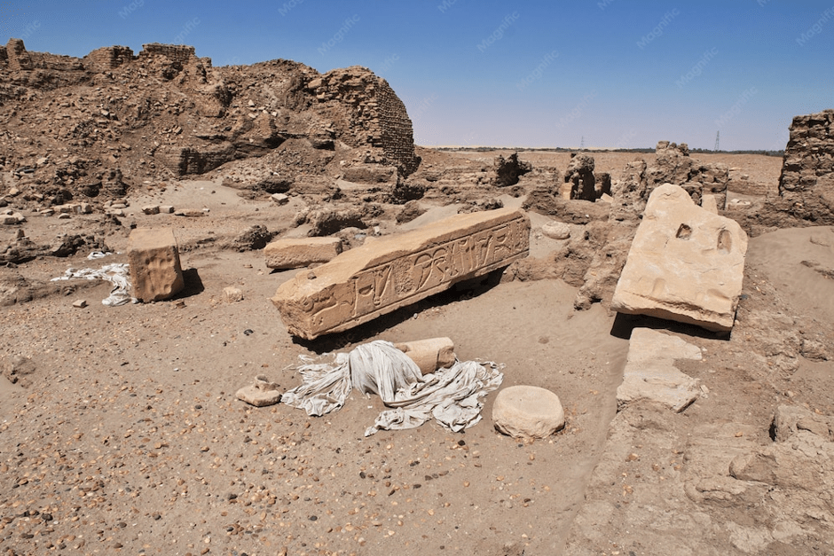
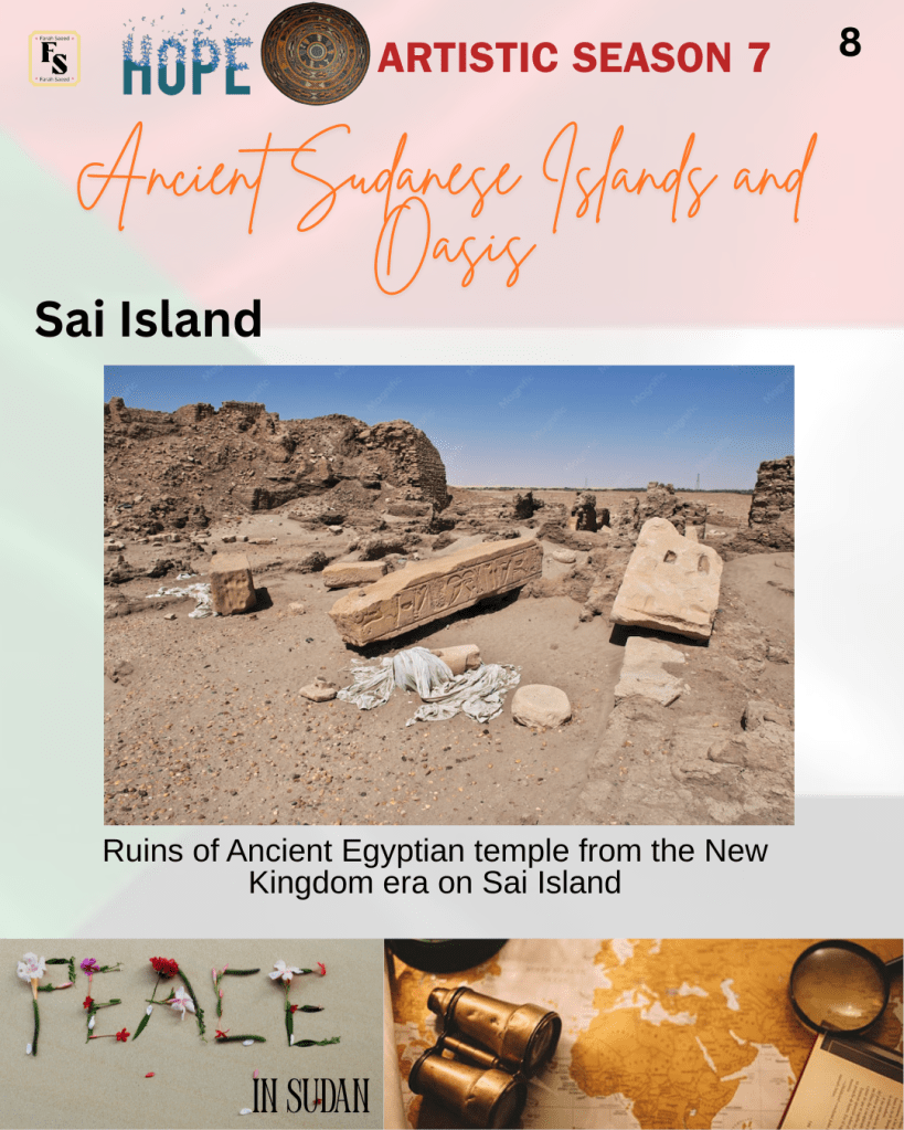
The Middle Kingdom built multiple fortresses on the island to protect the Egyptian southern border and approaches to the gold mines of Nubia. Researchers claimed it was a strategic point for the Ancient Egyptians during the New Kingdom (1539-1077 BCE) as they battled with the Ancient Kushites and built their first town on the territory. The town included a temple and a large administrative centre. The Nubia was able to regain its independence after several centuries, and Sai became part of the Kingdom of Napata (9th – 3rd century BCE) and later the Kingdom of Meroe (3rd century BCE – mid-4th century CE) when the capital moved further south to Boutana. There are column capitals carved with Queen Amanitore and King Natakamani names indicating evidence from the Meroite Kingdom. Today, there is evidence of funerary complexes that illustrate cross-cultural significance with Ancient Egypt. Ongoing studies are being made to reveal the Kushite necropolises that are currently partially explored.
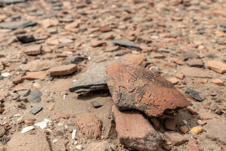
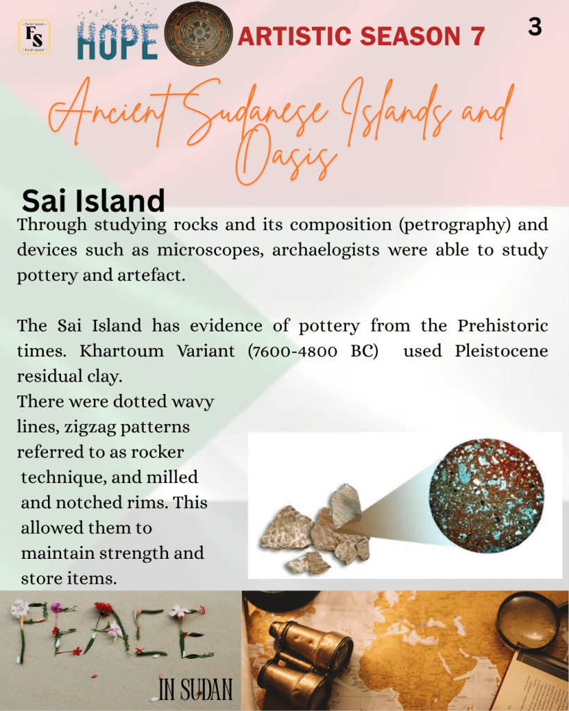
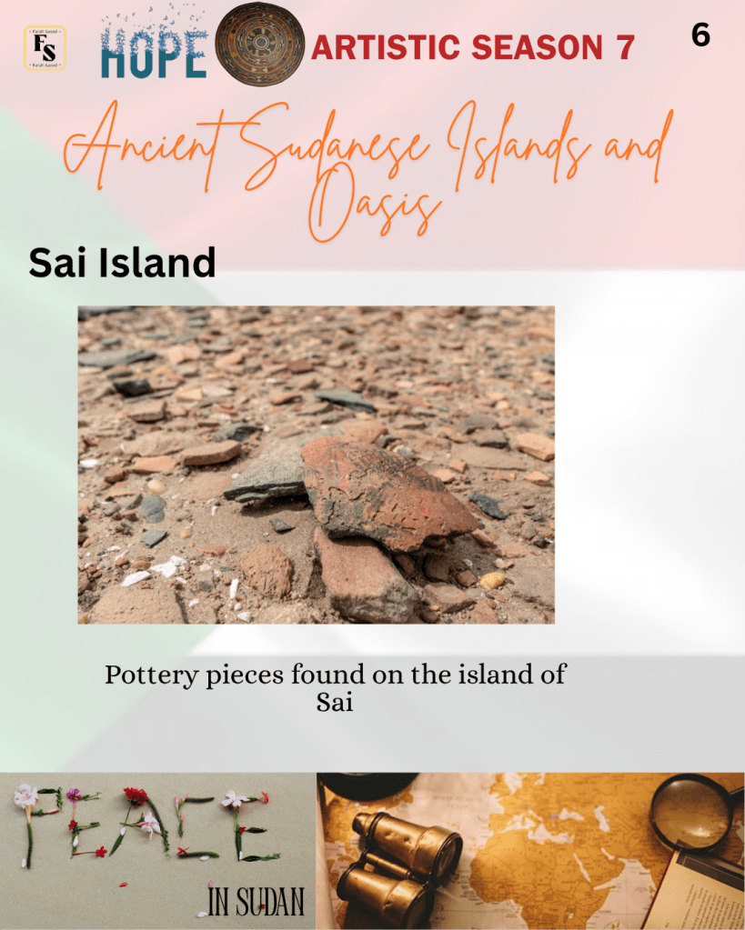
Recently, researchers have found that the ceramic makers from the Khartoum Variant (7600-4800 BC) did not have a lot of knowledge about how to make pottery, where they predominantly used coarse-grained open bowls and jars that were not well organised within the material. Pleistocene residual clay was the primary ingredient. . This enabled them to be resistant to mechanical stress and had high levels of quartz and K-feldspars to maintain their mechanical properties and store heavy-duty items.
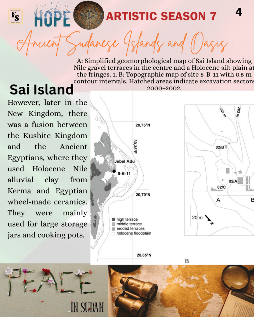
On the other hand, the New Kingdom had a fusion between handmade pottery from Kerma and Egyptian wheel-made ceramics. The Nubian vessels were mainly used for cooking pots and large storage jars. They were identifiable through the black-topped fine ware, incised and rocker decorations. The Nubian-style pottery was symbolic of the Abkan vessels, petrographically who sometimes had these patterns, but on other occasions, the vessels had straight and rounded walls and were undecorated. Some surfaces were burnished (polished by rubbing). They also made baskets and mats. However, the type of clay was distinctive from the Khartoum variant and contained Holocene Nile alluvial clay as the raw material, and the paste was prepared with organic tempers. Though the origin of the clay is different, the pottery makers used similar raw materials and knew which were suitable for their functional purposes.
On the contrary, during the latter part of the 18th Dynasty (1539–1292 BC) of the New Kingdom, the rocker decorations were discontinued. This indicates that through the study of pottery, the method in which the pottery was made was established, as presented during chaîne opératoire, the style, function, and aesthetic were different, and there was new skill and practice.
Selima Oasis
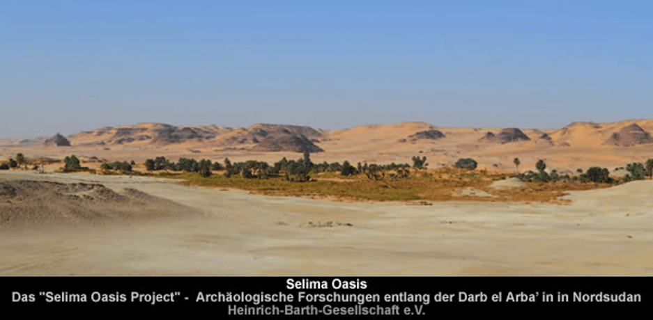
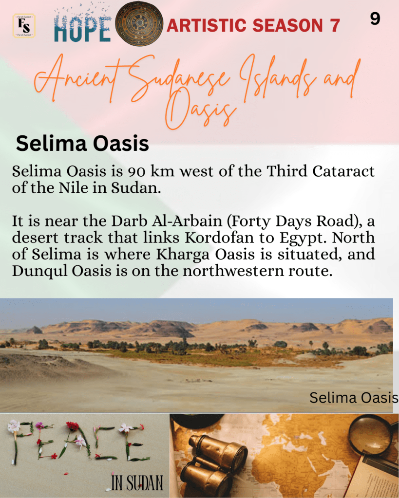
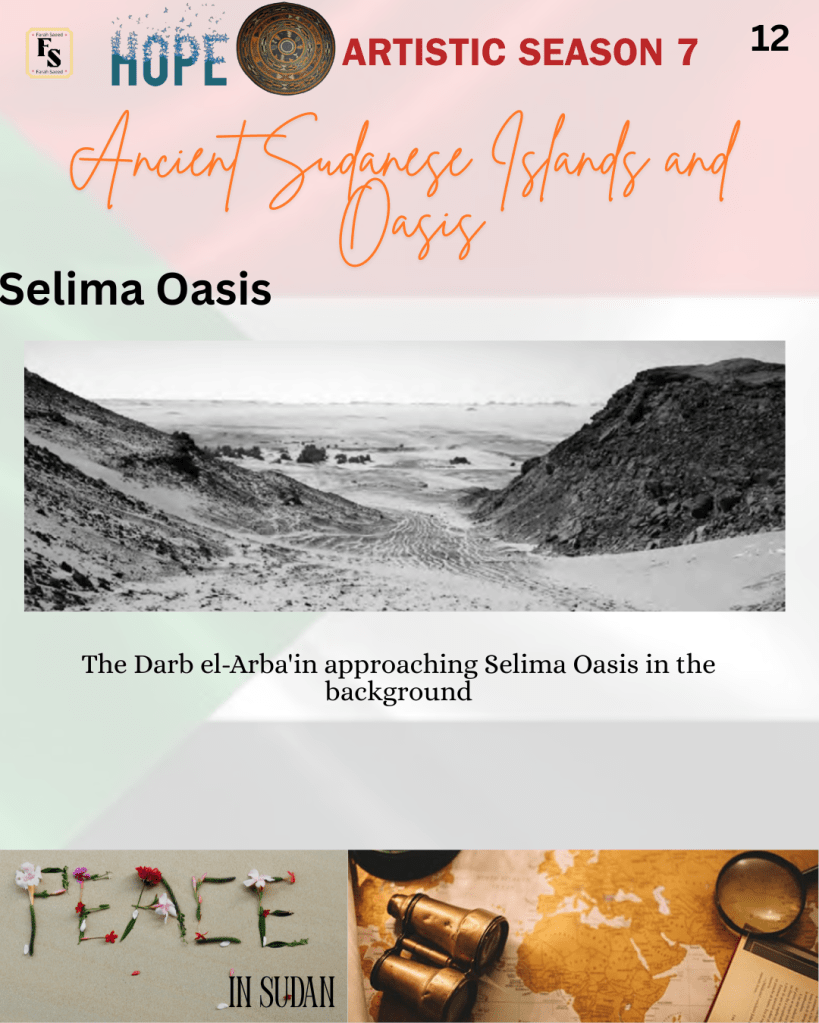
Selima Oasis is 90 km west of the Third Cataract of the Nile in Sudan. It is near the Darb Al-Arbain (Forty Days Road), a desert track that links Kordofan to Egypt. North of Selima is where Kharga Oasis is situated, and Dunqul Oasis is on the northwestern route. An archaeologist, William Boyd Kennedy Shaw, compared the Selima to Libyan oases, “loveliest of all Libyan oases”. Early simple archaeological work took place in the 1970s and 1980s, but major excavations were in 2011, 2013, and 2014.
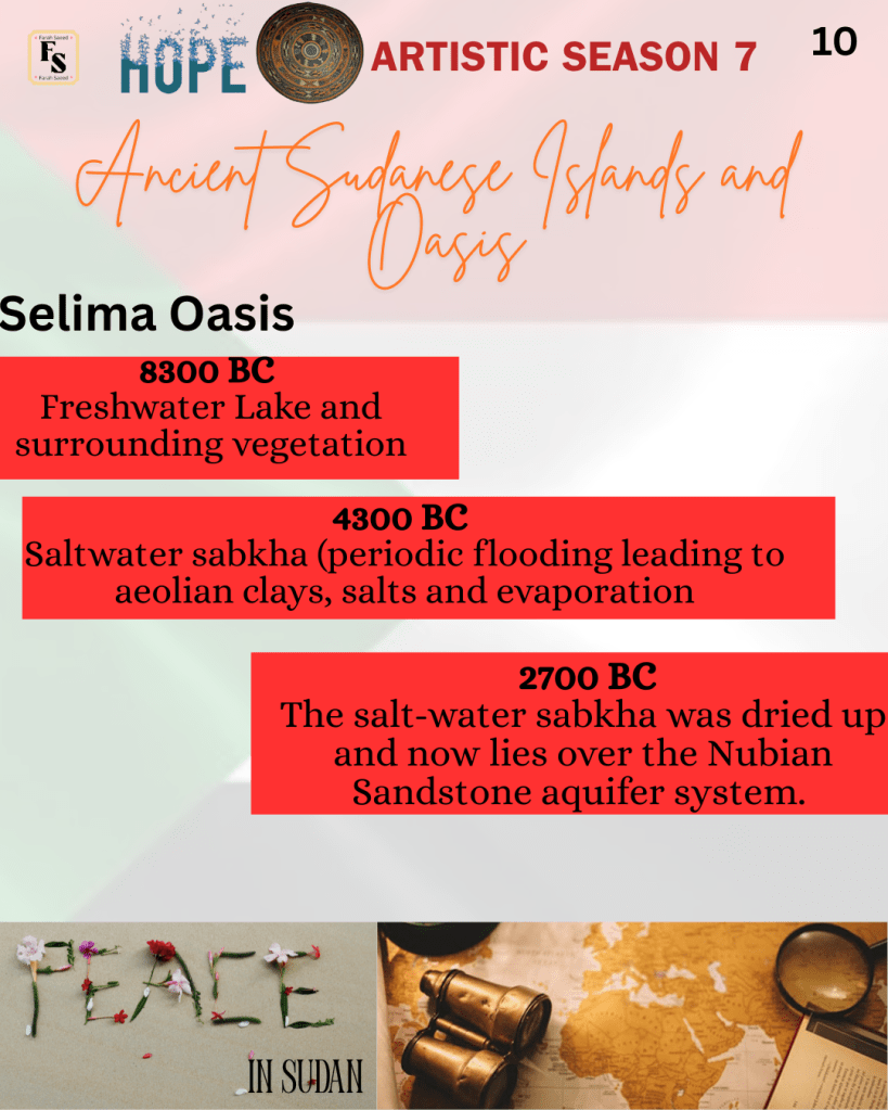
Selima Oasis is surrounded by vegetation and contains artefacts from the Prehistoric (Palaeolithic). There is pottery from the Mesolithic period. At around 8300 BC, it was a freshwater lake with surrounding vegetation. It transferred into a saltwater sabkha in 4300 BC. A sabkha is an area where periodic flooding and evaporation lead to aeolian clays, salts, and evaporates in North Africa and Arabia. In 2700 BC, the saltware sabkha was dried up and now lies over the Nubian Sandstone aquifer system. In 1928, archaeologist Thomas Leach hypothesised that salt may have been mined at Selima, which came from Sukkot, Argo, and Mahas, where there were salt caravans from Sagiat el-Abr in the Nile valley. The last salt caravan took place in 1980.
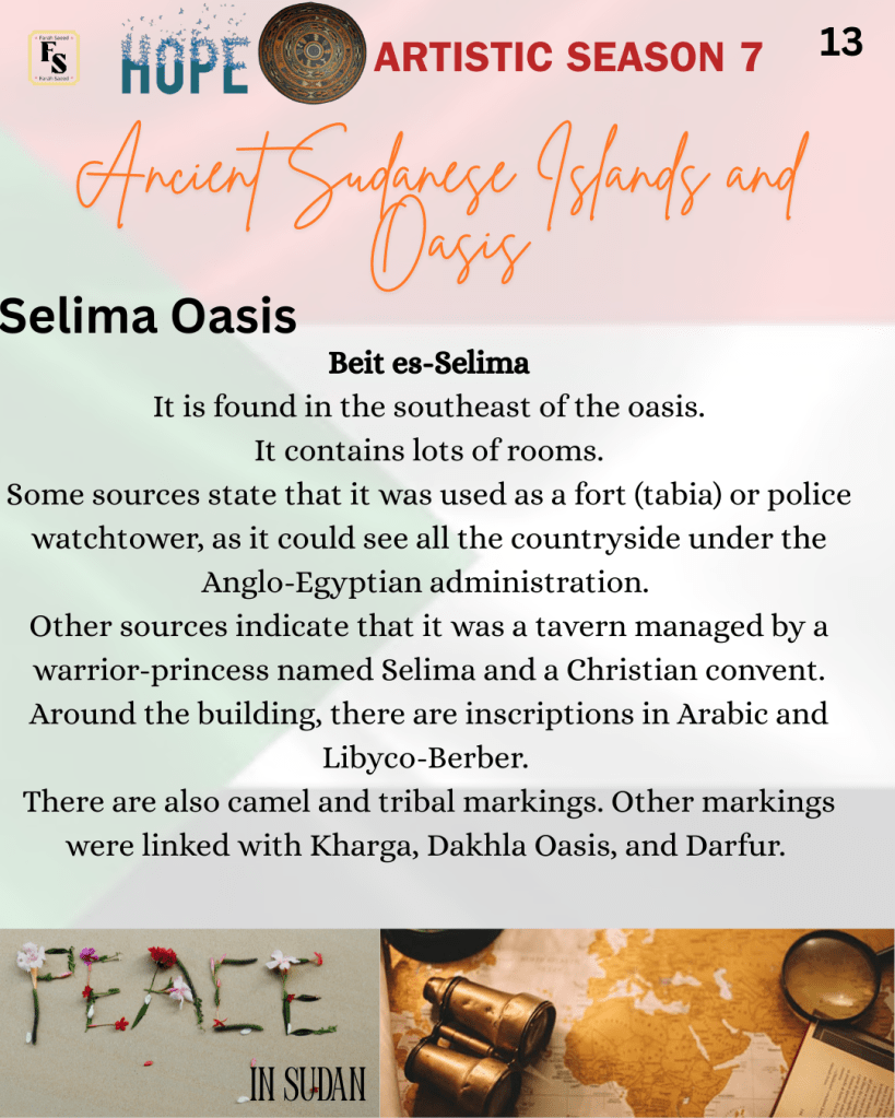
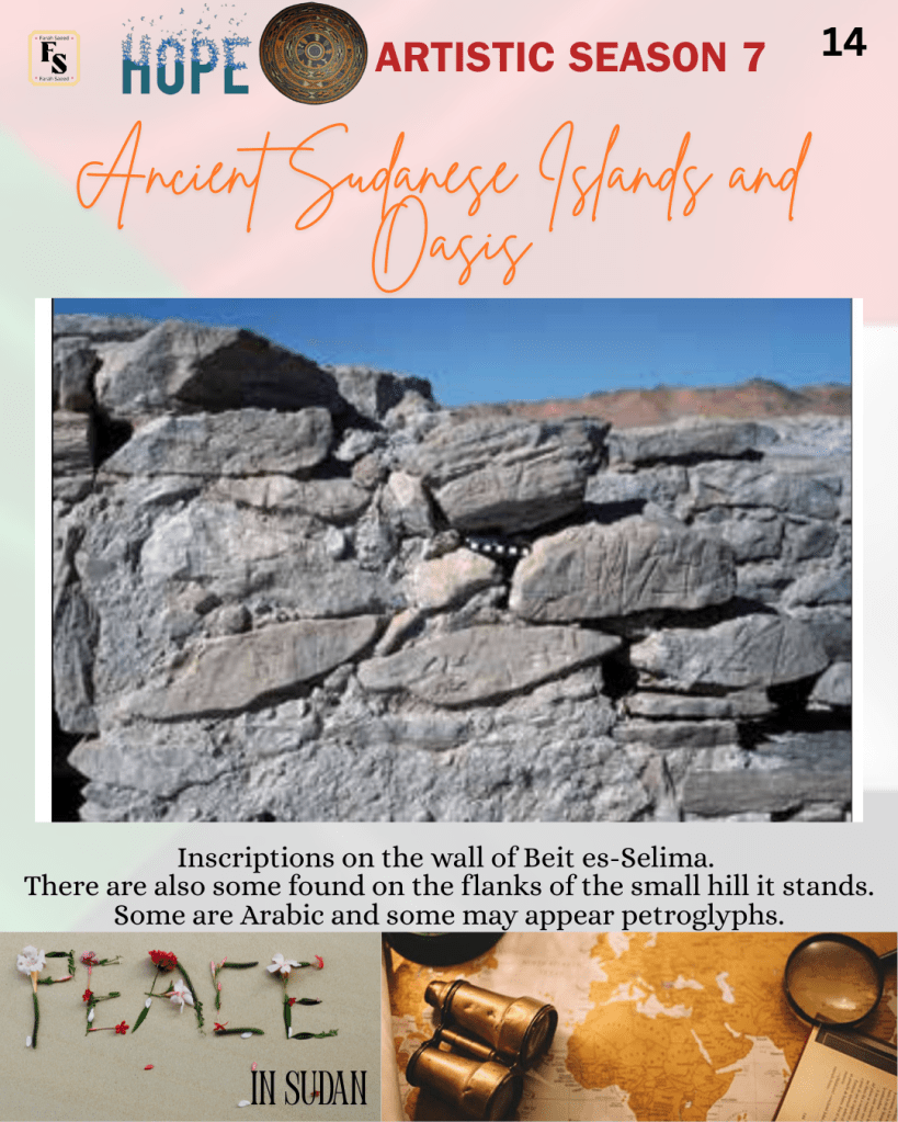
Selima Oasis has been used as a travelling route to Kerma, especially by the Egyptian official Harkhuf. In the southeast of the oasis, vegetation is Beit es-Selima, an ancient stone structure containing lots of rooms. Carbon dating and potsherds trace back to the Nubian early (AD 600–850) and classical (AD 850–1100) Christian periods. Pot sherds are broken pieces of ceramic material. Most of the pottery was wheel-made and had few decorative pieces. Around the building, there are inscriptions in Arabic and Libyco-Berber. There are also camel and tribal markings. Other markings were linked with Kharga, Dakhla Oasis, and Darfur. Some sources state that it was used as a fort (tabia) or police watchtower, as it could see all the countryside under the Anglo-Egyptian administration. Other sources indicate that it was a tavern managed by a warrior-princess named Selima and a Christian convent.
Overall, Sudan’s islands and oases hold significant archaeological remains from multiple periods. Petrographic and chaîne opératoire analyses reveal ceramic production and cultural interactions through the pottery and architecture present at the site. Selima Oasis and Sai Island are key sites with complex occupational histories from prehistoric to medieval times.

References
Budka, J. and Doyen, F. (2012) Life in New Kingdom Towns in UPPER Nubia- New Evidence from Recent excavations on Sai Island Austrian Academy of Sciences 22, pp. 167-208. Available at: https://www.jstor.org/stable/43552818 (Accessed: 5th July 2026)
D’Ercole, G., Budka, J., Sterba, J.H., Garcea, E.A.A. and Mader, D. (2017). The successful ‘recipe’ for a long-lasting tradition: Nubian ceramic assemblages from Sai Island (northern Sudan) from prehistory to the New Kingdom. Antiquity, 91(355), pp.24–42. doi:10.15184/aqy.2016.262.
Derrien, F. and Jesse, F. (2015) Archaeology at Selima Oasis, Northern Sudan – recent research. Available at: https://www.academia.edu/37622631/Archaeology_at_Selima_Oasis_Northern_Sudan_recent_research (Accessed: 5th July 2026)
Everything Explained Today (2026) Selima Oasis Explained. Available at: https://everything.explained.today/Selima_Oasis/ (Accessed: 5th July 2026)
Ministere De la culture (2026) Saï: an island at the heart of Nubia. Available at: https://archeologie.culture.gouv.fr/en/sai-island-heart-nubia (Accessed: 5th July 2026)
Section Française de la Direction des Antiquités du Soudan (2024) Sai Island https://sfdas.hypotheses.org/5430 (Accessed: 5th July 2026)
UNESCO World Heritage Centre (2026) Sai Island. Available at: https://whc.unesco.org/en/tentativelists/6595 (Accessed: 5th July 2026)
Van Peer, P. (2023). Sai Island (Site 8-B-11), Sudan. Handbook of Pleistocene Archaeology of Africa, pp.1013–1025. doi:10.1007/978-3-031-20290-2_66.

Leave a comment