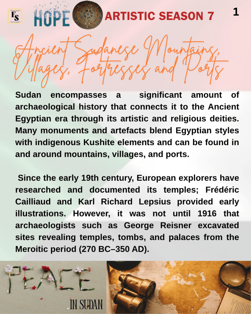
Sudan encompasses a significant amount of archaeological history that connects it to the Ancient Egyptian era through its artistic and religious deities. Many monuments and artefacts blend Egyptian styles with indigenous Kushite elements and can be found in and around mountains, villages, and ports. Since the early 19th century, European explorers have researched and documented its temples; Frédéric Cailliaud and Karl Richard Lepsius provided early illustrations. However, it was not until 1916 that archaeologists such as George Reisner excavated sites revealing temples, tombs, and palaces from the Meroitic period (270 BC–350 AD).
To better understand these discoveries, it is important to clarify the historical timeline of Sudan’s ancient kingdoms. The Napatan period (about 900–270 BC) marks the era when Napata was the main political and religious center of the Kingdom of Kush, closely linked to Egyptian culture. Around 270 BC, there was a gradual transition as the royal capital moved south to Meroe, beginning the Meroitic period (c. 270 BC–350 AD), which is distinguished by the development of new artistic styles, writing, and religious practices unique to the region. While there was some overlap between the late Napatan and early Meroitic traditions, the shift from Napata to Meroe marked a significant change in the focus of the kingdom’s power and cultural identity. Meroe served as the final capital of the Kushite Kingdom from around 270 BC until its decline in the 4th century AD.
To further clarify abbreviations, BC and CE both indicate years in history, but BC refers to “Before Christ,” while CE stands for “Common Era,” a secular, non-religious term and an alternative to “Anno Domini” (AD). AD in Latin means “in the year of our Lord,” which is after the Prophet Jesus’s birth. BCE stands for “Before Common Era,” which is a secular, non-religious alternative to BC and corresponds to the years before CE. The BCE/CE system was introduced in the 17th century for academic, scientific, and interfaith perspectives. There is no difference in numerology: 100 BCE is the same as 100 BC, and 2026 CE is the same as 2026 AD.
Additional efforts were made in the 1970s by the University of Rome La Sapienza and the Boston Museum, where more monuments, inscriptions, and artefacts were discovered from the Napatan era (900 – 270 BC) and displayed in global museums. This provided an insight into the Ancient Kushite civilization, culturally, historically, and its religious landscape. Modern technology has further helped to extrapolate the ancient world of Sudan, whose architectural tradition shaped the political, religious, social, and artistic scene of the Middle and Northern Nile Valley for more than 2000 years (1500 BC- 6th Century AD). For example, archaeologists now use tools such as remote sensing to identify buried structures without excavation, radiocarbon dating to accurately determine the age of organic materials, and digital mapping with geographic information systems (GIS) to document site layouts and features. These technologies have significantly advanced archaeological understanding and allow researchers to investigate sites in greater detail and with less disturbance to the original remains. The aim of this article is to provide insight into the limited but significant archaeological activity that took place at Jebel Barkal, Banganarti, and Suakin.
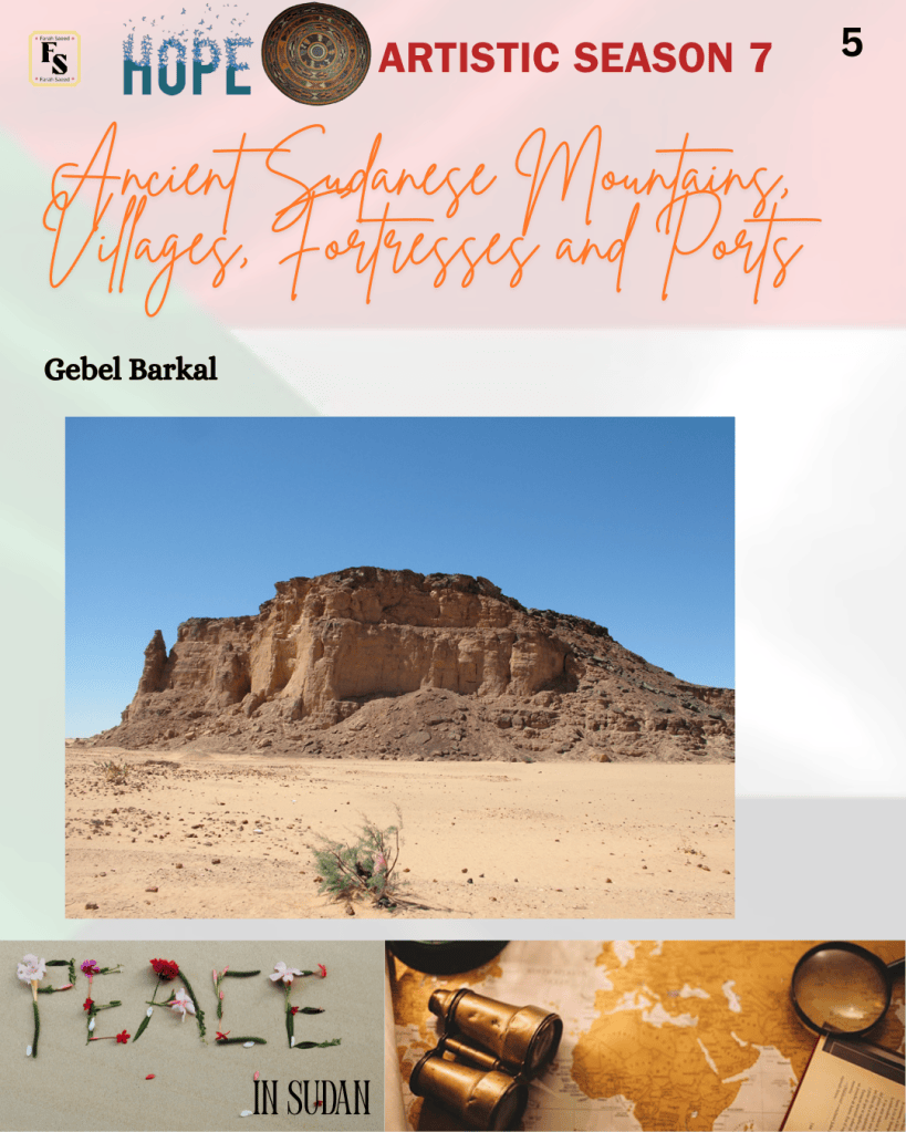
Jebel Barkal
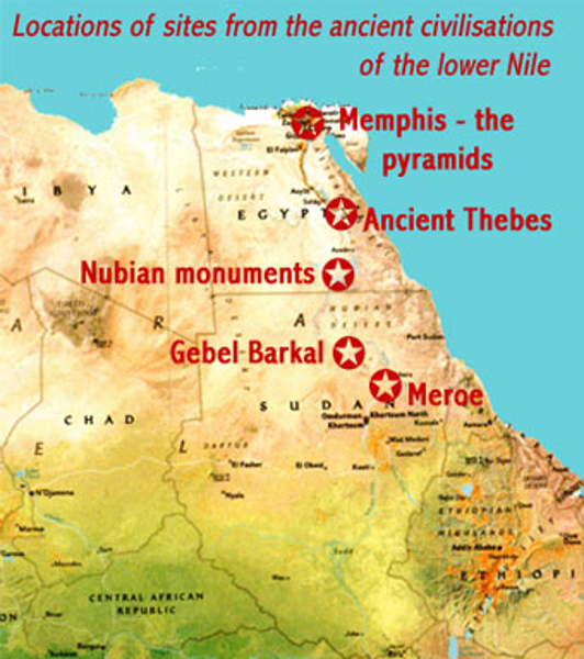
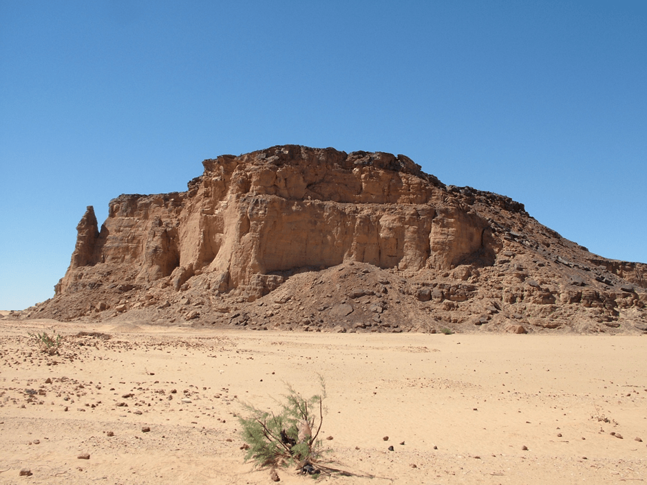
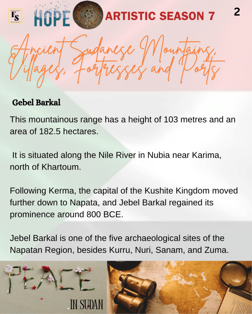
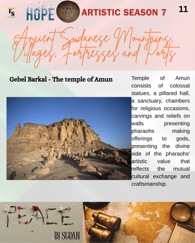
This mountainous range has a height of 103 metres and an area of 182.5 hectares. It is situated along the Nile River in Nubia near Karima, north of Khartoum. Following Kerma, the capital of the Kushite Kingdom moved further down to Napata, and Jebel Barkal regained its prominence around 800 BCE. Jebel Barkal is one of the five archaeological sites of the Napatan Region, besides Kurru, Nuri, Sanam, and Zuma.
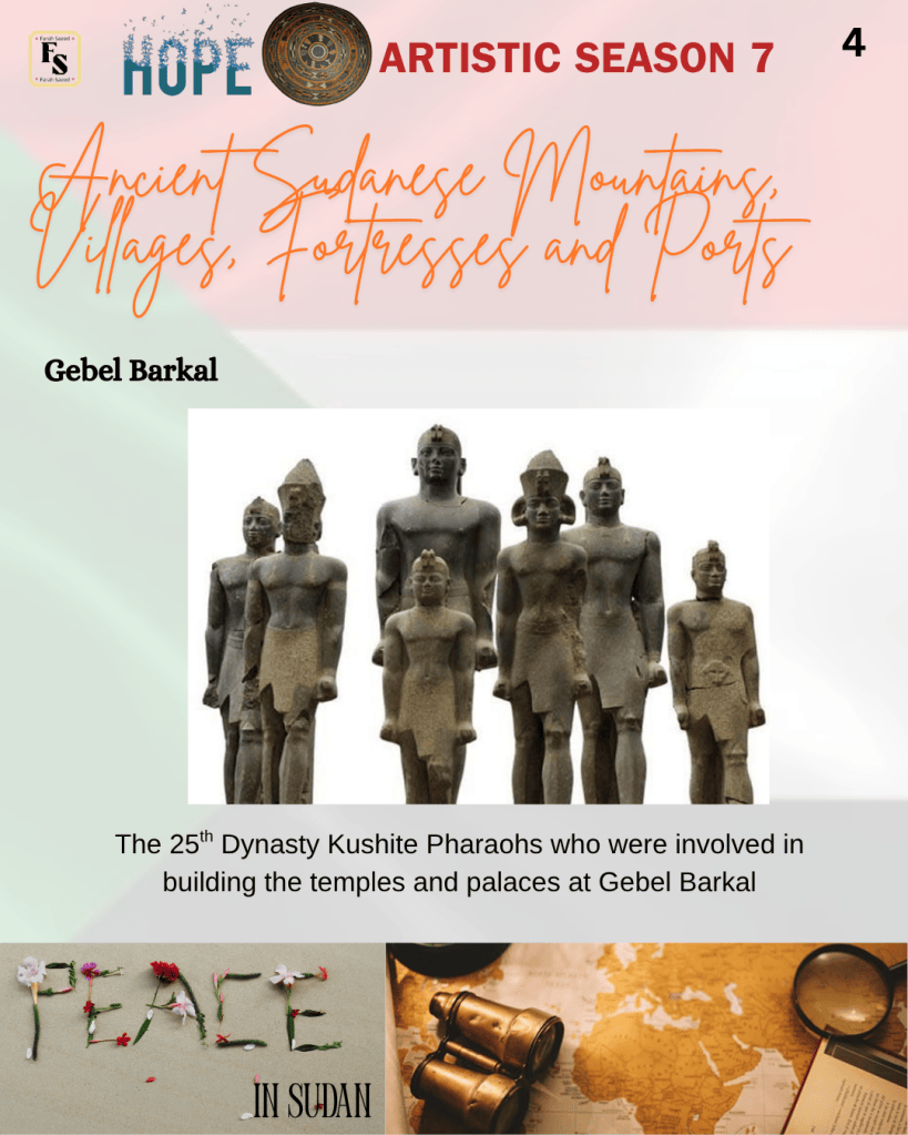
Additional monuments were built in Jebel Barkal during the 25th Dynasty by Kushite pharaohs, who incorporated Egyptian religious traditions into their way of life: Kashta, his son Piankhy (Piye), and his grandson Taharqa. This includes temples, tombs, burial mounds, chambers, living complexes, and palaces. Jebel Barkal was important even after the Assyrian conquest by Esarhaddon, who defeated Taharqa and sacked Memphis in 671 BCE. Taharqa’s successor, Tantamani, tried to reclaim Egypt but retreated to Napata. By 656 BCE, Kush’s influence over Egypt ended.
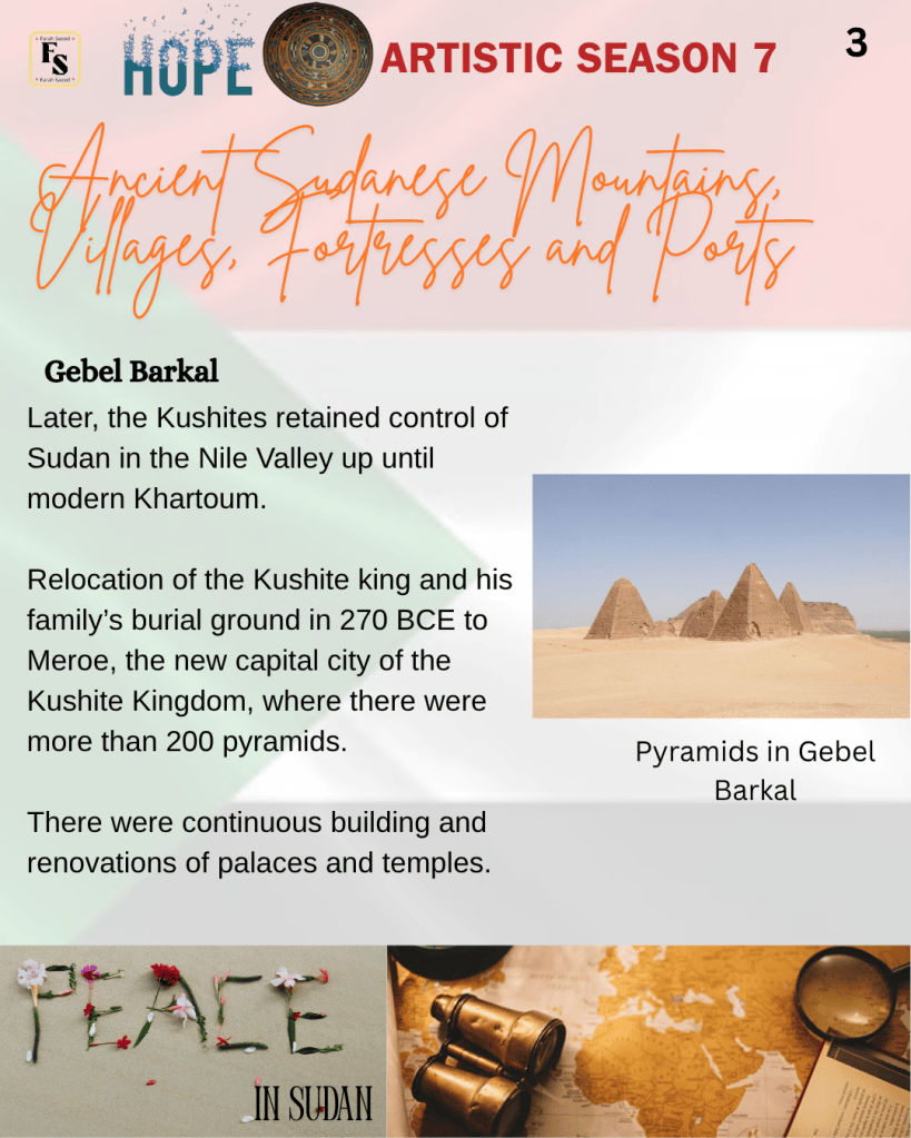
Later, the Kushites retained control of Sudan in the Nile Valley up until modern Khartoum. Relocation of the Kushite king and his family’s burial ground in 270 BCE to Meroe, the new capital city of the Kushite Kingdom, where there were more than 200 pyramids. There were continuous building and renovations of palaces and temples. It is estimated that there were eight royal pyramids between the 1st century BCE and the 1st century CE. After the decline of the Kushite Kingdom in the 4th century CE, Jebel Barkal was embraced during the Christian era as a settlement. This can be observed through the remnants and burial inscriptions. Therefore, Jebel Berkal was a spiritual, social, and political epicentre.
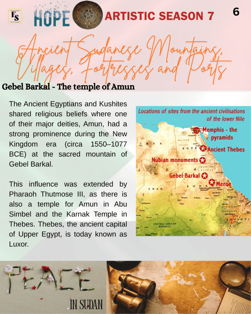
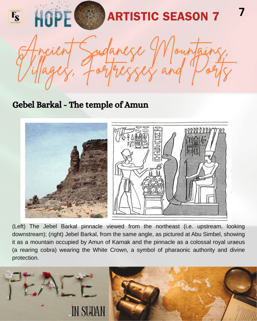
The Ancient Egyptians and Kushites shared religious beliefs where one of their major deities, Amun, had a strong prominence during the New Kingdom era (circa 1550–1077 BCE) at the sacred mountain of Gebel Barkal. This influence was extended by Pharaoh Thutmose III, as there is also a temple for Amun in Abu Simbel and the Karnak Temple in Thebes. Thebes, the ancient capital of Upper Egypt, is today known as Luxor. Today, many locals visit the mountain due to a Muslim sheikh who passed away and is buried near 100 m high on a flat-topped sandstone rock. Hence, it is locally named Gebel Wad El-Karsani.
The temple of Amun
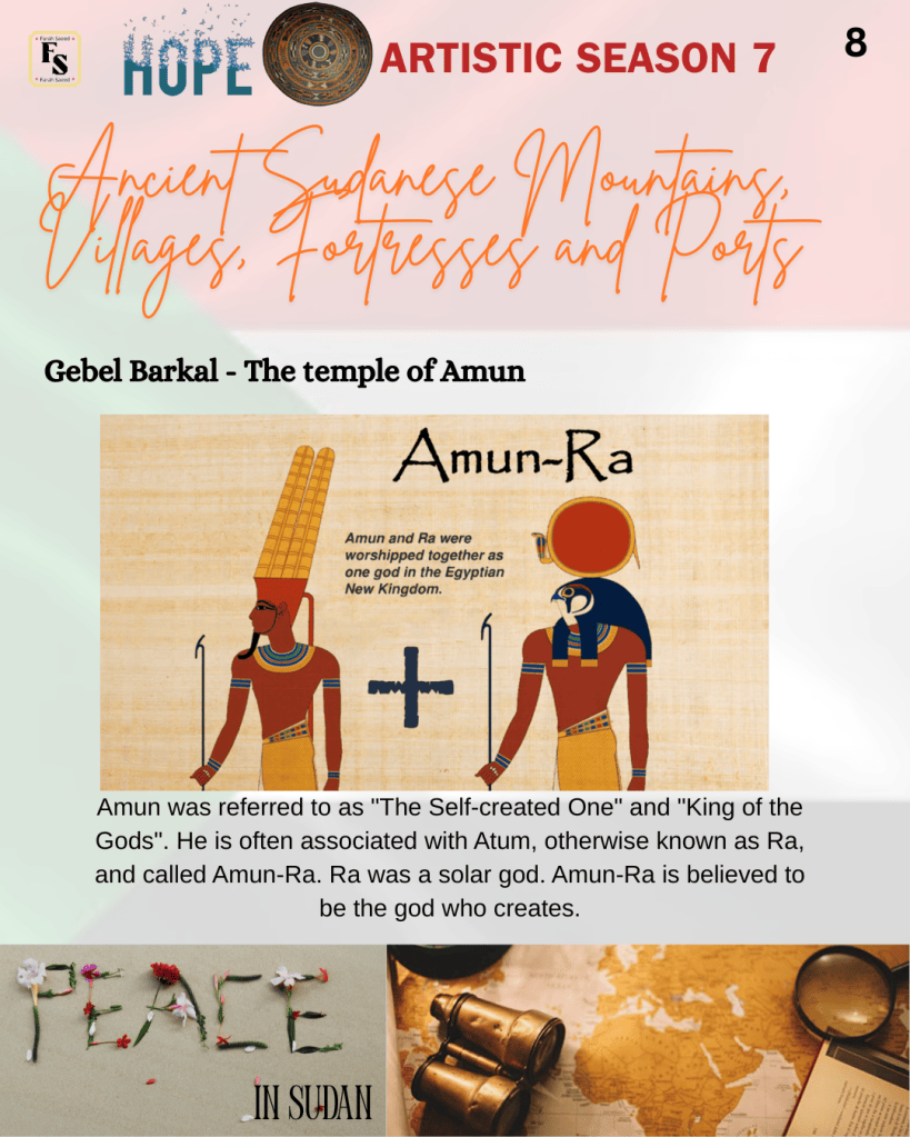
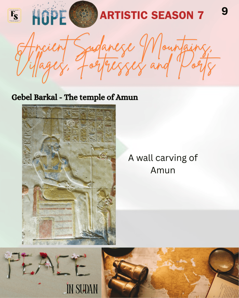
The Ancient Egyptians believed that Amun was the god of the sun and air, fertility, and also protected the King. Hence, he was referred to as “The Self-created One” and “King of the Gods“. He is often associated with Atum, otherwise known as Ra, and called Amun-Ra. Ra was a solar god. Amun-Ra is believed to be the god who creates. Wilkinson writes how “the Egyptians themselves called him Amun asha renu or ‘Amun rich in names,’ a However, Min, the ancient god, was linked with him and was referred to as Amun-Min. Amun was first mentioned in the Pyramid Texts (c. 2400 – 2300 BCE). Amun contains epithets to attach to the name, presenting various qualities the god presents.
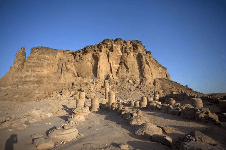
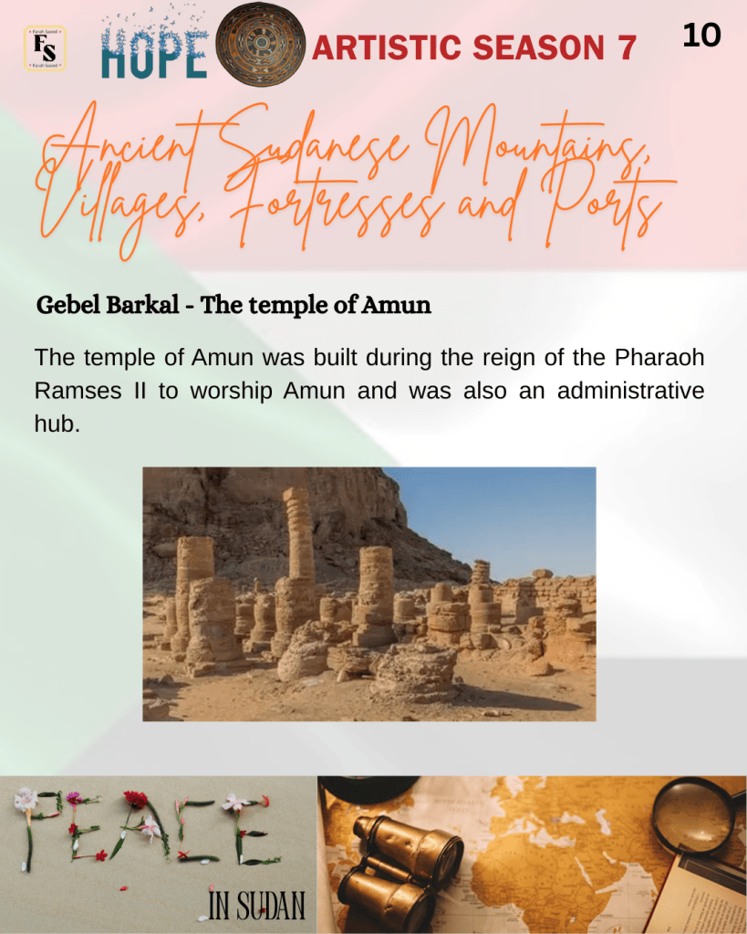
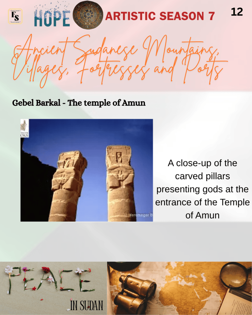
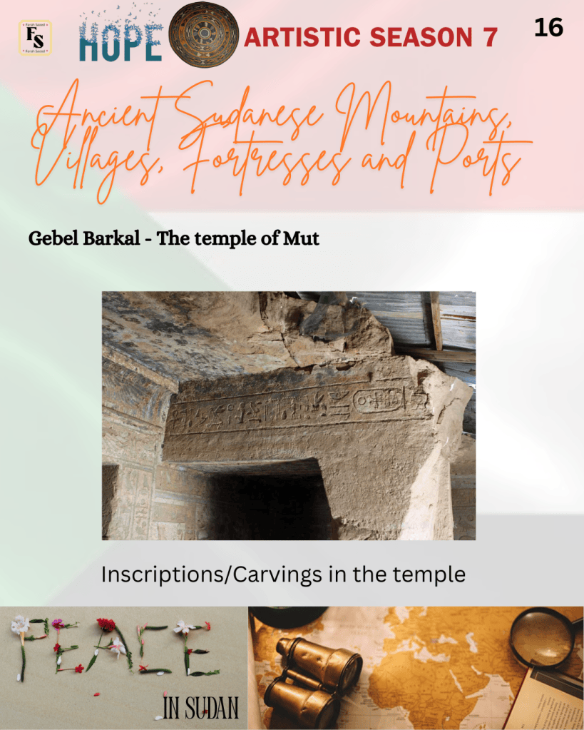
The temple of Amun was built during the reign of the Pharaoh Ramses II to worship Amun and was also an administrative hub. It consists of colossal statues, a pillared hall, a sanctuary, chambers for religious occasions, carvings and reliefs on walls presenting pharaohs making offerings to gods, presenting the divine side of the pharaohs’ artistic value that reflects the mutual cultural exchange and craftsmanship rather than an adoptive technique between Ancient Kushite and Pharaonic civilizations. They were merging them with native Kushite gods to fit and adapt local beliefs – Amun was assimilated with the Kushite god Apedemak, illustrating distinctive differences.
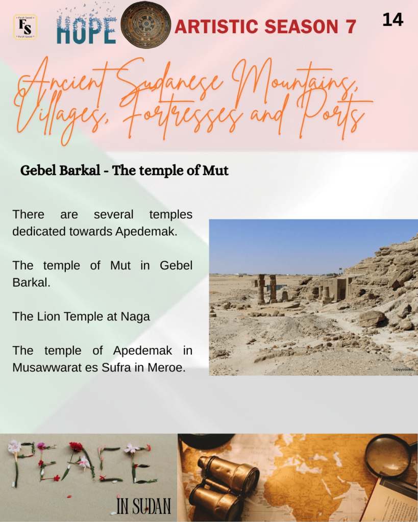
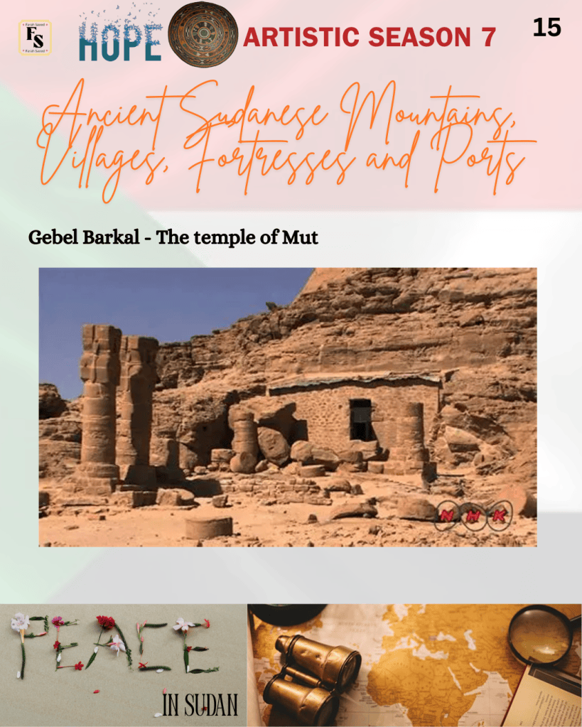
The temple of Mut
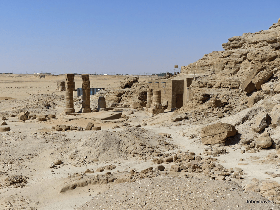
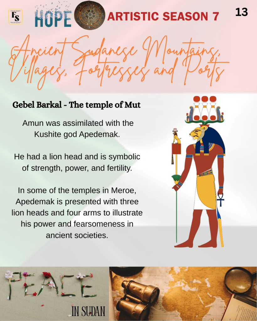
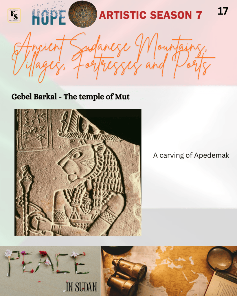
This temple consists of painted chambers and architectural work presenting Kushite pharaohs and the lion-headed god Apedemak. The origin of Apedemak is from Kerma, the first kingdom of Kush between 2500 BC and 1500 BC. It was known for its artistic view of lions. He was often carrying a bow and leading people in captivity. The appearance of a Lion was symbolic of strength, power, and fertility. It was later applied during the Meroitic Nubia around 800 BC. According to the Meroites, they believed Apedemak brought victory to armies during war and conflict. In some of the temples in Meroe, Apedemak is presented with three lion heads and four arms to illustrate his power and fearsomeness in ancient societies. Other images present him as a lion-headed cobra.
An alternative temple was built in the 1st century AD and is referred to as the Lion Temple at Naga. It was built by King Natakamani and his wife Queen Amanitore, where Apedemak images are even in the pylon. Another temple of Apedemak was Musawwarat es-Sufra in Meroe, where it was excavated by John Garstang from 1909 to 1910. The temple contained a votive plaque of King Tanyidamani made of dark red siltstone where Apedemak appears as a lion-headed figure with a male human torso.
Other artifacts in Jebel Barkal
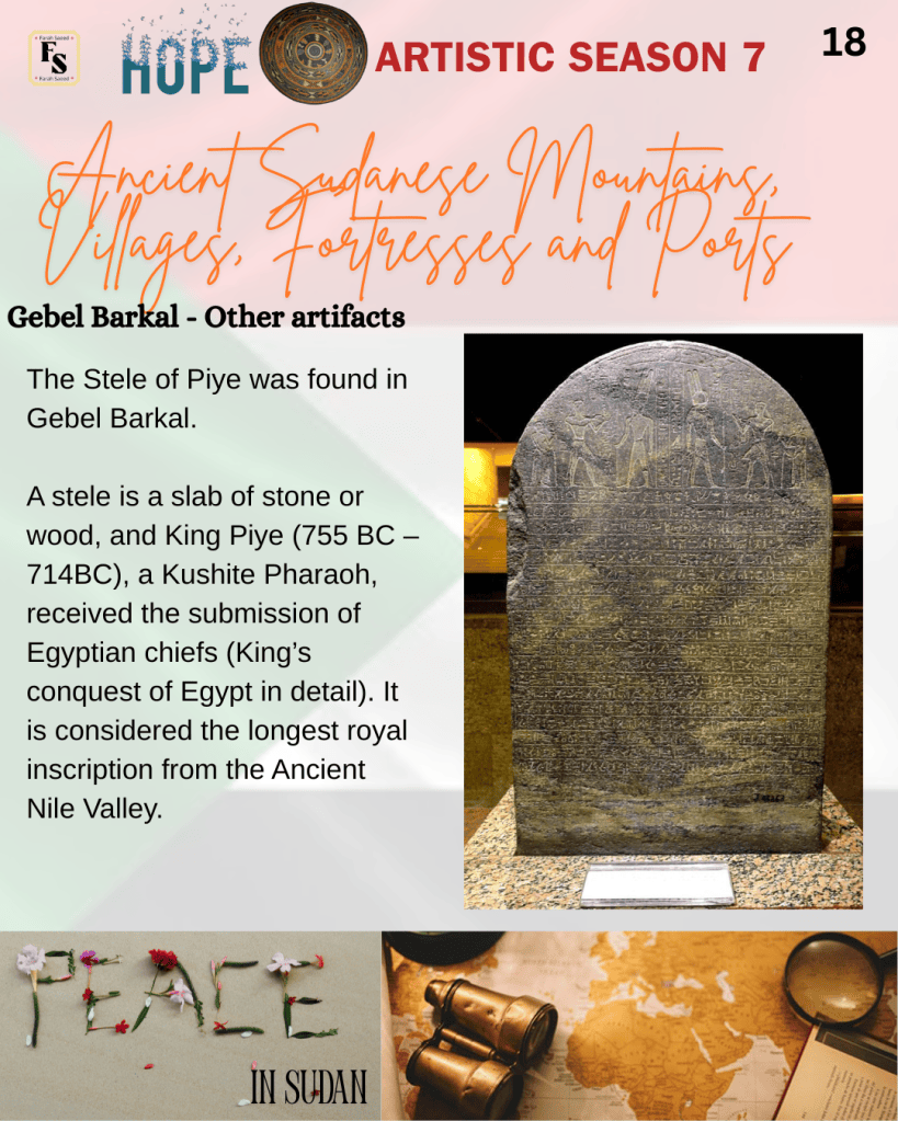
The Stele of Piye was found in Gebel Barkal. A stele is a slab of stone or wood, and King Piye (755 BC – 714BC), a Kushite Pharaoh, received the submission of Egyptian chiefs (King’s conquest of Egypt in detail). It is considered the longest royal inscription from the Ancient Nile Valley. The stele has distinct orthographic and stylistic features. It illustrates Piye’s military conquest and spiritual devotion to Amun. Piye unified Egypt under his rule and was inspired by his father, King Kashta, who conquered Southern Egypt in the mid-8th century BC and was fascinated by Egyptian artefacts, which influenced the Napata and Kushite Kingdoms.
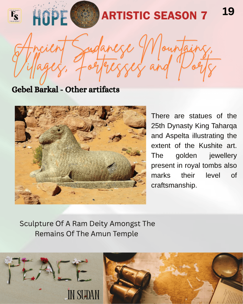
Moreover, in Jebel Barkal, there are statues of the 25th Dynasty King Taharqa and Aspelta illustrating the extent of the Kushite art. The golden jewellery present in royal tombs also marks their level of craftsmanship.
Banganarti
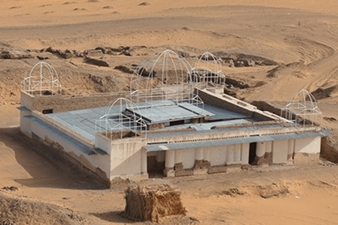
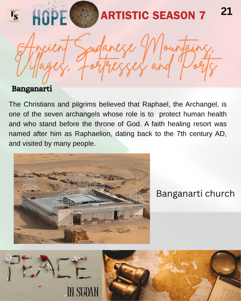
Banganarti is a small village near the right eastern bank of the Nile between the Third and Fourth cataracts and is part of the Nubian Kingdom. In the historical context, a cataract is a large rapids of water over rocks or waterfalls along the Nile River. They are naturally formed and typically found from Ethiopia to Egypt. Approximately, it is seven and a half kilometers down Tungul/Old Dongola, the capital of the Kingdom of Makuria. Archaeologists first excavated at Banganarti in 2001, where they revealed an upper church dedicated to Raphael Archangel built on the ruins of a lower church. The presence of pottery found there is also associated with the lower church.
Christianity developed around the sixth century AD, when missionaries from the Byzantine Empire and Constantinople came to Nubia and Christianity became the dominant religion. Three Christian Nubian kingdoms came to power by the late 4th century CE: Nobadia, Makurra, and Alwa. It marked the end of the Kush. In the North, it was Nobadia with its capital at Faras. In the centre, it was Makuria, with its capital at Old Dongola. In the South, it was Alwa (Alodia) at Soba East. Nobadia later joined Makuria. Around the 7th century, the northern kingdoms of Nubia and Makuria united both their governments and their churches, with Makuria becoming miaphysite.
Other sources indicate that there was a competition between the orthodox Byzantine Emperor Justinian and his miaphysite wife Theodora. A priest named Julian, sent by Theodora, reached Nobadia first. The king of Alwa sent an embassy to Nobadia requesting that Nobadia send a priest to the southern kingdom. A bishop named Longinus eventually reached Alwa after some difficulty crossing Makuria. The adoption of Christianity in Makuria, on the other hand, was a result of an embassy that the kingdom had sent to Constantinople in the reign of Justin II. This indicates Christianity existed because of the Nubian church, priests, and royals.
Between the 7th and 14th centuries AD, there were many churches, monasteries, and other religious buildings built throughout Nubia. These buildings were used regularly for worship and were a massive part of ancient Banganarti culture.
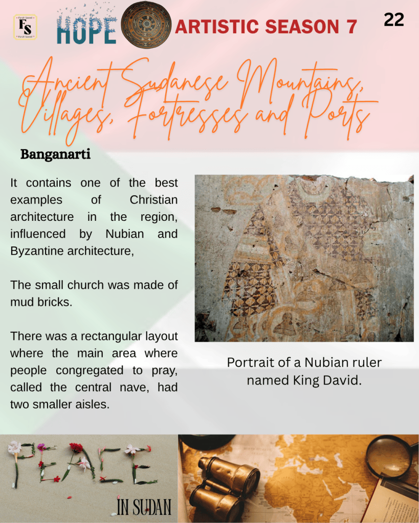
The Christians and pilgrims believed that Raphael, the Archangel, is one of the seven archangels whose role is to protect human health and who stand before the throne of God. A faith healing resort was named after him as Raphaelion, dating back to the 7th century AD, and visited by many people. It contains one of the best examples of Christian architecture in the region. The small church was made of mud bricks, which were a common building material. There was a rectangular layout where the main area where people congregated to pray, called the central nave, had two smaller aisles. The walls of the church are decorated with inscriptions and graffiti for visitors. There is a recessed brick technique traced back to the 11th-century Byzantine architecture. There was a fusion between Byzantine and Nubian architectural elements and styles. There were also frescoes throughout the church besides carved motifs. Fresco is a painting made quickly in watercolour in a quick way. An example of its significance was when, during the fourteenth century, there was a plague, and the causal factor of the Black Death was considered to be linked to God’s anger, so the pilgrims tried to seek prayer and forgiveness by visiting religious places.
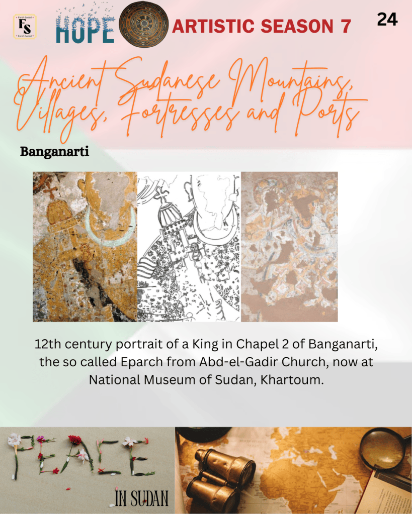
In each of the seven chapels, the eastern wall had an image of a king wearing an emblem or symbol depicting their royal status, known as regalia. This illustrates the extent to which the king was important in religion in Nubia.
Byzantine Egypt was later conquered by the Arabs, where relations with Old Dongola, the miaphysite/coptic church in Alexandria, and the churches of Upper Egypt were halted.
Suakin
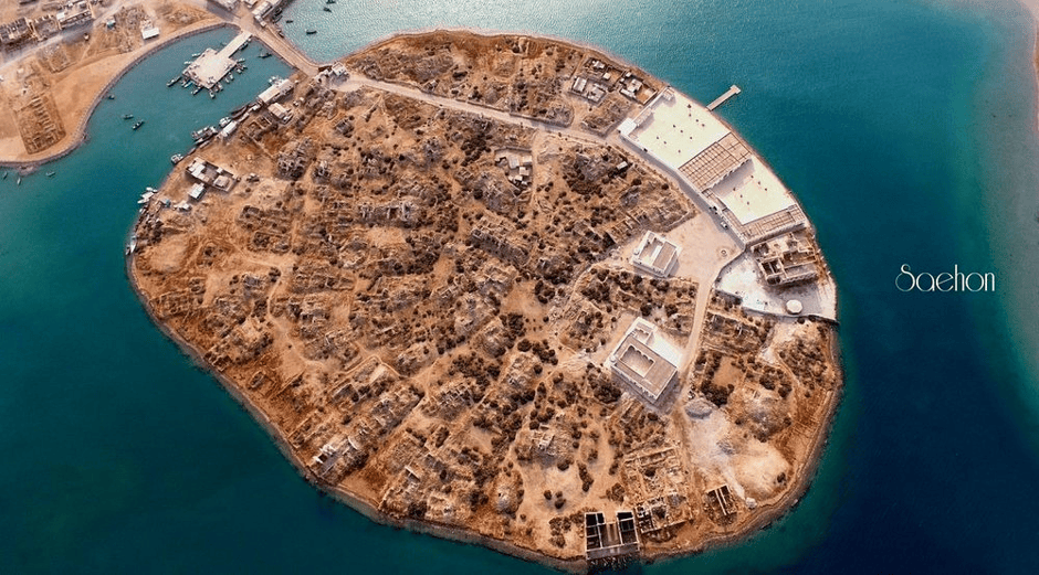
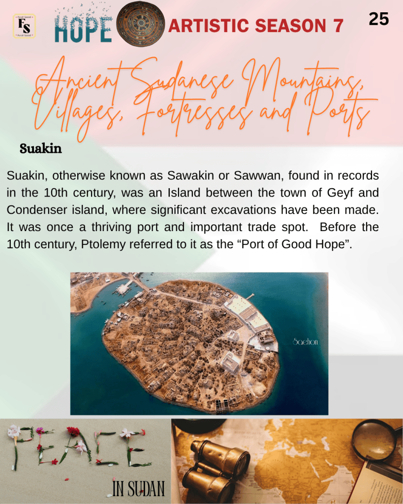
Suakin, otherwise known as Sawakin or Sawwan, found in records in the 10th century, was an Island between the town of Geyf and Condenser island, where significant excavations have been made. It was once a thriving port and important trade spot. Before the 10th century, Ptolemy referred to it as the “Port of Good Hope”.
The ruler of Suakin, Ala al-Din al-Asba’ani, stole the goods of local deceased merchants. In response to this, the governor of Qus, along with the support of Aydhab, attacked Suakin. A small settlement then grew into a new trading centre by Venetian merchants around the 14th century, after the invasions by the Crusades and Mongols. In the following century, the Adal Sultanate of the Horn of Africa, Portugal, and Turkey’s Ottoman Empire tried to repair Suakin’s architecture. Suakin also had more than 300 buildings, such as homes, mosques, offices, and other buildings.
Moreover, Suakin was often approached by people who underwent the Islamic pilgrimage called Hajj and Umrah. In the early 16th century, the Ottoman forces advanced down the coast, following the conquest of Egypt in 1517, and Suakin became an Ottoman port.
During the 19th century, Suakin was part of a major centre for the ivory trade from elephants in the nearby hinterlands. This was exported around the world and boosted the economy. Other industries they had were making ships, farming, and fishing from different countries, which influenced their language, religion, and architecture.
On the other hand, overhunting of elephants led to the downfall of Suakin due to high demand, strain on elephant herds that became endangered. Alternative sources of ivory, such as those in East Africa, were more convenient for the colonial empires there. It also changed the port to the Red Sea, Zanzibar in Tanzania, and Mombasa in Kenya. There was an advent of materials like plastic and synthetics reduced the demand for ivory and made it cheaper and more accessible. Ivory trade and other industries faced a downfall in their economy. Trade moved to Port Said, Ismailia, and the Suez Canal in 1869 in Egypt. Conversely, it was short-lived, and Port Sudan was opened along the coast in 1903.
Masjid Al-Shafi’i
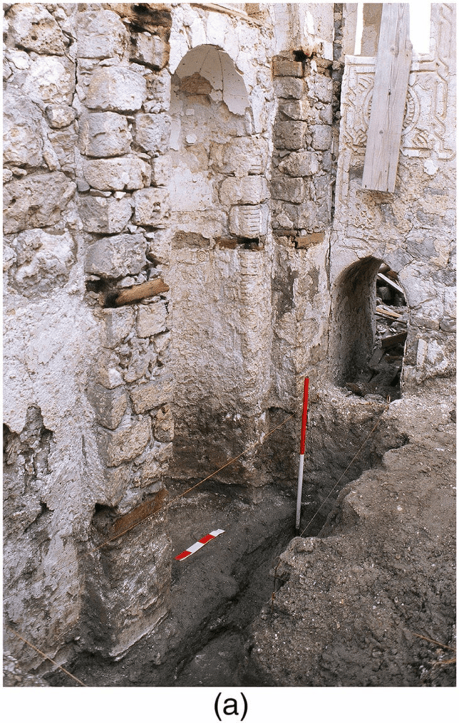
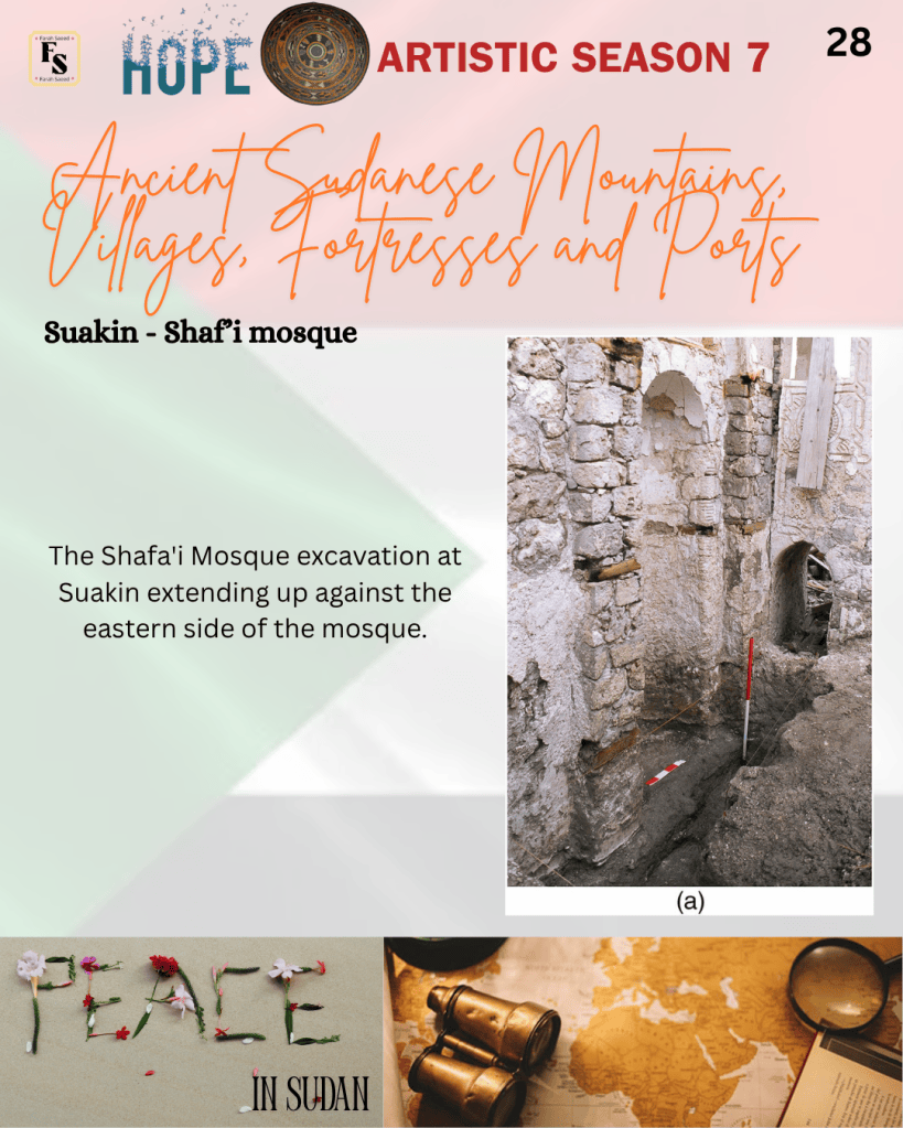
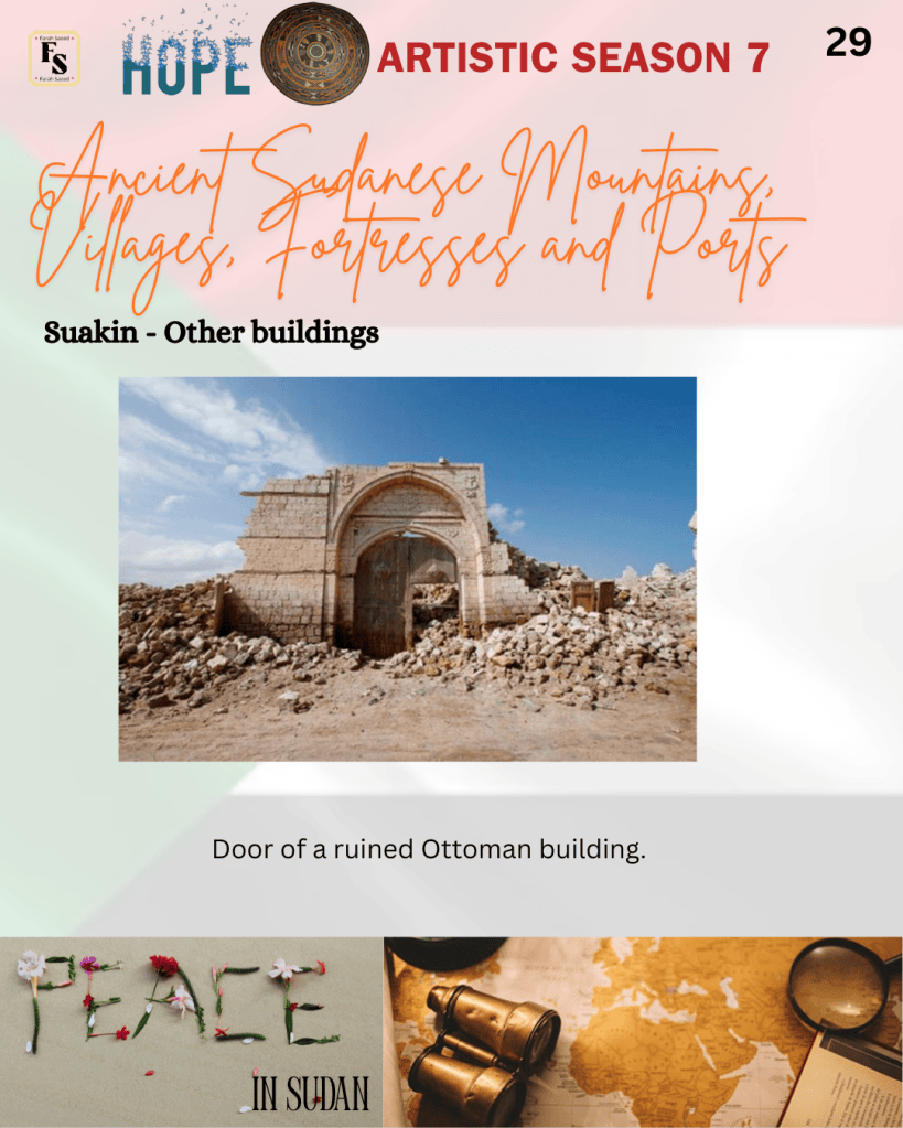
One of the main mosques excavated in Suakin is the Shafi’i mosque. This took place in the early 2000’s and revealed that earlier structures existed beneath the present structures. Further excavation took place in 2006/2007, where a round base extending down 60 cm on top of the rectangular base or pier in the centre of the open court structure, but the identity of this structure is yet to be known. There were additional excavations in the interior and exterior of the east walls and the central part of the south arcade, presenting multiple layers that extend to a water table or bedrock. The supporting inscription dates between the late 11th and 13th centuries AD.
Traditional homes
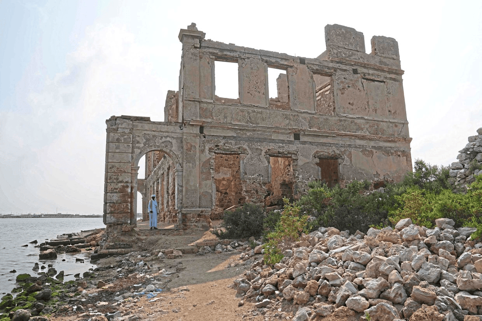
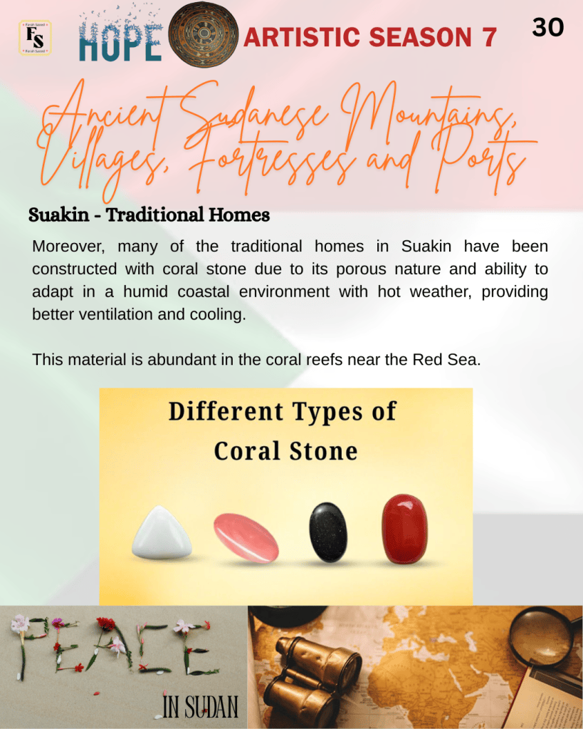
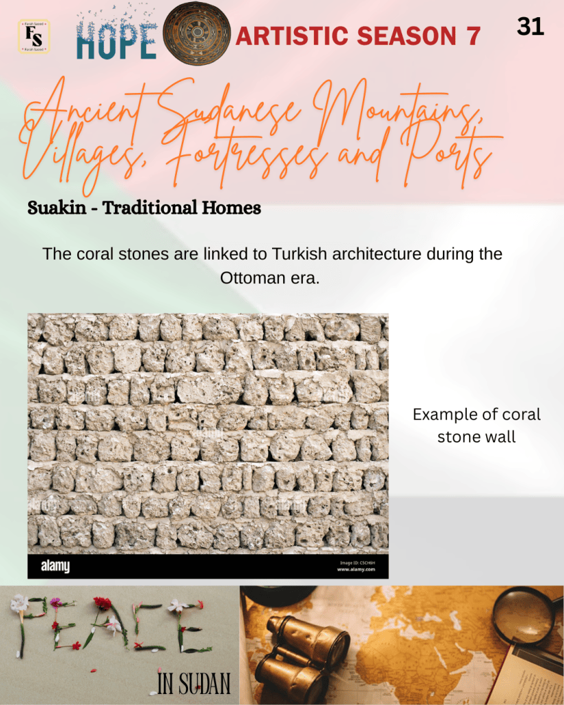
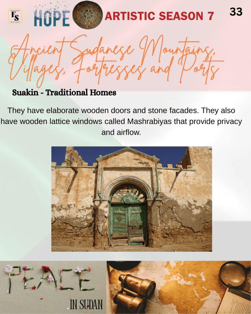
Moreover, many of the traditional homes in Suakin have been constructed with coral stone due to its porous nature and ability to adapt in a humid coastal environment with hot weather, providing better ventilation and cooling. This material is abundant in the coral reefs near the Red Sea. The coral stones are linked to Turkish architecture during the Ottoman era. Besides the coral stones, the walls are coloured white to reflect the sun and provide an additional cooling effect. They have elaborate wooden doors and stone facades. They also have wooden lattice windows called Mashrabiyas that provide privacy and airflow.
Overall, Sudan’s archaeological sites reveal a blend of Egyptian and Kushite influences. Jebel Barkal, Banganarti, and Suakin each played unique roles in Sudanese history. Religious, political, and economic shifts shaped Sudan’s monuments and cultural landscape.

References
Ahmed Adam (2019) New perspectives on the archaeology of the Medievalperiod in the Red Sea area of the Sudan, Azania: Archaeological Research in Africa, 54(4), pp. 487-500. Available at: https://www.researchgate.net/publication/366199384_Azania_Archaeological_Research_in_Africa_New_perspectives_on_the_archaeology_of_the_Medieval_period_in_the_Red_Sea_area_of_the_Sudan (AccessedL 13th July 2026)
Biswas, S. (2026) BC, AD, CE, and BCE: Meanings and Differences Explained. Available at: https://www.calendarr.com/united-states/bc-and-ad-their-meaning-and-differences/ (Accessed: 13th July 2026)
Fondation Max van Berchem (2026) Introduction: Archaelogical work at Suakin Available at: https://maxvanberchem.org/en/11-archeologie/57-archaeological-work-at-suakin (Accessed: 13th July 2026)
Hage, R. (2025) The Traditional Architecture of Sudan – A Historical and Regional Survey. Available at: https://www.arabamerica.com/the-traditional-architecture-of-sudan-a-historical-and-regional-survey/ (Accessed: 2nd May 2026)
Leigh, L. (2023) The Forgotten Ghost Town of Suakin: A Journey Into Its Thriving Past. Available at: https://www.ancient-origins.net/ancient-places-africa/suakin-0018118 (Accessed: 13th July 2026)
Lex Leigh (2023) The Raphaelion, the Ancient Christian Faith Center of Banganarti. Available at: https://www.ancient-origins.net/ancient-places-africa/raphaelion-banganarti-0020131 (Accessed: 13th July 2026)
Mark, J. (2016) Amun Available at: https://www.worldhistory.org/amun/ (Accessed: 13th July 2026)
Mythical Encyclopedia (2026) Apedemak: Mythical Creature. Available at: https://mythicalencyclopedia.com/apedemak/ (Accessed: 13th July 2026)
Samuel, I. (2023) Self-representation in African art: the wall paintings of medieval Nubia. (ca. 700-1400). Available at: https://www.africanhistoryextra.com/p/self-representation-in-african-art (Accessed: 13th July 2026)
The Archaelogist (2023) The Temple of Amun at Jebel Barkal: Its Role in Egyptian-Kushite Syncretism. Available at: https://www.thearchaeologist.org/blog/the-temple-of-amun-at-jebel-barkal-its-role-in-egyptian-kushite-syncretism (Accessed: 13th July 2026)
UNESCO World Heritage Centre (2026) Banganarti. Available at: https://whc.unesco.org/en/tentativelists/6597 (Accessed: 13th July 2026)
UNESCO World Heritage Centre (2026) Gebel Barkal and the Sites of the Napatan Region. Available at: https://whc.unesco.org/en/list/1073 (Accessed: 13th July 2026)
World Heritage Explorer (2026) Gebel Barkal and the Sites of the Napatan Region. Available at: https://worldheritageexplorer.org/sites/gebel_barkal_and_the_sites_of_the_napatan_region.html (Accessed: 13th July 2026)
World History Edu (2026) Jebel Barkal Available at: https://worldhistoryedu.com/jebel-barkal/ (Accessed: 13th July 2026)


Leave a comment